Data-Driven Vegetation Management Pays Off in the Storm
Key Highlights
- WREC used remote sensing imagery and analytical tools to identify vegetation encroachment and prioritize maintenance efforts across its diverse service territory.
- The eight-year cycle allowed WREC to focus on high-risk corridors first, optimizing resource allocation and reducing unnecessary work in lower-risk areas.
- The storm in June 2025 confirmed the program's success, as circuits cleared during the first year experienced no outages, reinforcing the value of data-guided vegetation management.
- Enhanced staff training and dedicated oversight helped coordinate maintenance efforts effectively, ensuring long-term system reliability.
- The program's success has increased member trust, supported by transparent communication and tangible results, including reduced wildfire risk and improved outage response.
In June 2025, a significant storm swept through northwestern Minnesota, bringing strong winds and widespread tree damage across Wild Rice Electric Cooperative’s (WREC) service territory. When the crews assessed what happened, one result stood out: the circuits that had been cleared during the first year of a new vegetation management program experienced zero outages.
That outcome didn’t happen by chance. It was the payoff from a decision WREC made a year earlier: to build on an already active vegetation management effort and take it to the next level with data.
The Problem with Not Knowing Where to Look
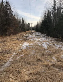
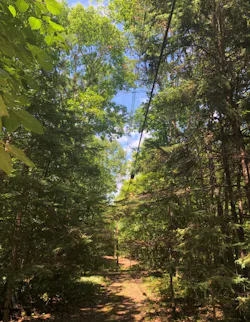
WREC serves a diverse territory in northwestern Minnesota that includes open farmland, wooded corridors and lakeshore communities where seasonal homes sit close to power lines. Founded during the rural electrification era of the 1930s, the member-owned utility maintains 2,935 miles of overhead line and 715 miles of underground line and has long treated vegetation management as a core reliability function. Crews regularly trim trees and maintain ROW corridors to keep lines clear.
The cooperative had steadily invested in its vegetation program over the years, and that commitment was clear. But as the distribution network expanded and corridor conditions varied across the territory, leadership wanted a more complete picture.
WREC prioritized work based on field observations and member feedback, which was effective for addressing immediate needs. What was harder to see was the full scope of conditions across the entire system and how maintenance should be sequenced to have the greatest long-term impact on reliability.
WREC serves both year-round rural residents and seasonal lakeshore communities, operating in a territory where reliability expectations are high and every budget decision is accountable to the member-owners who depend on the system. Strengthening the vegetation management program was a high priority.
The challenge wasn’t the commitment to vegetation work. That commitment was already there. The challenge was gaining a clearer, system-wide view of corridor conditions so that resources could be directed with confidence.
While WREC knew how its line miles and system were laid out, it didn’t have a clear picture of where vegetation pressures were building and where the work would make the biggest difference.
There was also a deeply personal dimension to solving the problem. WREC’s 18 lineworkers are the ones who are in the field when outages occur, working in demanding conditions to restore service as quickly as possible. They take enormous pride in their work and in the reliability of the system they maintain. Building a stronger vegetation program wasn’t just about satisfying the board or reducing costs. It was about giving those crews the tools and the plan they needed to do their jobs more effectively.
WREC connected with the Davey Resource Group (DRG) at an industry meeting, which led to the system assessment.
What the Data Revealed
Using remote sensing imagery and analytical tools, the assessment evaluated vegetation conditions across every corridor in WREC’s service area. The analysis identified where canopy coverage was encroaching on lines, how corridor conditions varied across the territory and where maintenance was most likely to affect reliability.
The numbers told a clear story. About 32 percent of WREC’s ROW corridors contained significant vegetation encroachment. The remaining 68 percent were already in relatively clear, well-maintained condition.
For WREC, those findings were clarifying. The cooperative’s territory is genuinely diverse, with open farmland and corridors running through areas with little to no tree cover alongside lakeshore communities where vegetation is dense. Seeing the full picture confirmed that the cooperative’s years of investment in vegetation work had produced real results across a large portion of the system, and that the remaining work, while substantial, was concentrated and plannable.
That meant WREC could stop treating every corridor the same and concentrate resources where vegetation was most likely to cause problems, a distinction that mattered enormously when justifying the budget to a board of member-owners. It also offered a defensible, data-backed basis for a long-term plan.
Just as importantly, the data gave WREC what it needed to justify assigning a dedicated vegetation manager. With a clear picture of the work ahead and a defined multi-year cycle, the cooperative could quantify what the program would require and make the case for investing in dedicated oversight.
Building an Eight-Year Cycle from the Data
With the assessment complete, WREC collaborated with DRG to translate the findings into a structured eight-year vegetation management cycle aligned with existing system patterns and available budget.
The eight-year timeframe was built around what the cooperative could realistically accomplish each year within its current budget. Across more than 3,600 miles of line, that meant clearing about one-eighth of the system annually, working circuit by circuit and coordinating work around substations and feeder lines. This approach allows crews to address multiple corridors within the same geographic area during each phase, reducing travel time and enabling vegetation work to be coordinated with other system maintenance when possible.
Corridors with higher vegetation density receive earlier treatment. Established, lower-risk areas are maintained through routine monitoring and periodic trimming as they come up in the rotation.
The analysis also identified where mechanical clearing would be most effective in the early years of the program, concentrating resources on higher-risk corridors and avoiding unnecessary work elsewhere.
Remote Sensing and the Technology Behind the Plan
The assessment relied on remote sensing analysis, including imagery and analytical tools, to examine ROW corridors and identify where vegetation was most likely to affect line clearances. These tools can reveal differences in vegetation density, canopy coverage and proximity to infrastructure across large geographic areas, giving utilities a system-wide view that field observations alone cannot efficiently provide.
The goal of the assessment was practical, not exhaustive. The team was not trying to inventory every tree. Instead, the objective was to identify where vegetation was encroaching on lines and where maintenance would have the biggest impact.
For utilities serving large rural territories, remote sensing provides a cost-effective way to evaluate corridor conditions across an entire network. The approach can be scaled to the utility’s needs and budget, from broad remote sensing that establishes a system-wide baseline to higher-resolution drone imagery for locations that require a closer look.
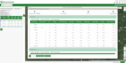
The findings were integrated into Davey’s ResourceKeeper platform, giving WREC an organized, circuit-level view of vegetation exposure across its territory. Rather than relying on scattered field reports, the cooperative could now connect assessment data directly to operational planning and track progress as the maintenance cycle advanced.
The technology doesn’t replace field knowledge or crew experience. It gives that knowledge a broader frame of reference.
Building Field Expertise Alongside the Program
As WREC implemented the post-assessment plan, it also strengthened the coordination of vegetation work. Like many smaller cooperatives, WREC relies on a combination of internal staff and outside contractors, with seasonal tree crews handling larger clearing projects and cooperative personnel addressing smaller issues as they arise.
DRG provided consulting utility forester (CUF) support to help translate the findings into day-to-day operations. That included coaching and training for the cooperative’s vegetation manager, helping the role evolve from coordinating individual maintenance needs to overseeing vegetation planning across circuits.
The individual who stepped into that role came from within WREC’s own team. He brought deep familiarity with the cooperative’s service territory, strong relationships with members and landowners and the kind of analytical, long-term orientation the role demanded.
In a program built around an eight-year cycle, that continuity matters. The vegetation manager coordinates with contractors ahead of each season, works through access permissions with members, and ensures that corridor work stays aligned with the plan.
Having the right person in that role, supported by DRG’s coaching and expertise, has been one of the most important factors in the program’s early success. Someone on the staff was made for the role because he knew the members and the ROWs, which made all the difference.
The Storm that Validated the Strategy
The June 2025 storm didn’t just test WREC’s distribution system. It tested the logic of the entire approach.
By the time the storm arrived, WREC had completed most of its first-year clearing cycle. The cooperative’s AMI system, which allows meters to report outage status in near real time, gave the operations team a detailed picture of where power had been lost across the territory.
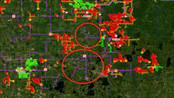
Circuits addressed during the first year of the vegetation management cycle performed markedly better than the surrounding areas. Where clearing work had been completed, there were no outages in those circuits. The storm was widespread enough to require mutual-aid crews from neighboring cooperatives to assist with restoration, making the contrast between treated and untreated corridors clearly visible on the outage map.
The outcome reinforced the program’s core premise. Focusing effort where it matters most, guided by data rather than intuition, produces measurable results when severe weather arrives. The storm showed WREC that the crews were working in the right places, which is what they were hoping the system assessment would demonstrate.
The results also gave WREC a powerful communication tool. The cooperative now shares updates on its vegetation program with members through direct mail and social media, and the storm data provided concrete evidence that the work matters. In a territory where seasonal residents value the visual character of lakeshore communities and some members are cautious about ROW clearing, being able to point to real results has helped build understanding and support for the program.
Wildfire risk has also shaped how WREC communicates about vegetation management. In a region with high-value lakeshore properties and forested corridors, reducing the potential for ignition from downed lines adds urgency to the program that resonates with members in ways that reliability statistics alone sometimes don’t.
What Comes Next
With the first year of the cycle complete, WREC continues to build on the foundation established by the assessment. Mechanical clearing remains a priority in the highest-density corridors as crews work through the eight-year plan.
The cooperative is also exploring complementary strategies for long-term corridor management. A selective herbicide program is under consideration to control regrowth between major clearing cycles and reduce the frequency of mechanical work needed to maintain safe clearances. WREC is also evaluating opportunities to establish compatible native vegetation within ROW. Lower-growing species can stabilize corridors and reduce the likelihood of taller trees re-establishing near distribution lines.
Continued use of remote sensing analysis and operational data is expected to support ongoing improvements in vegetation planning. As more information becomes available, the cooperative can refine maintenance priorities as conditions evolve.
The eight-year cycle is a foundation, not a ceiling. When the first rotation is complete, the data collected along the way will inform what the next cycle looks like and whether a different approach, including more targeted annual assessments of high-risk areas, might serve the cooperative even better.
The board has taken notice. As the vegetation program has matured and produced measurable results, it has strengthened confidence in WREC’s broader reliability investments and long-term planning.
Investing in a clearer understanding of where vegetation work matters most has left the cooperative better positioned to serve its members well. The storm made that case better than any report could.
Every year, the reliability gets better, and WREC knows it is on the right track, and for a cooperative like WREC, that is everything.
About the Author
Mike Wade
Mike Wade is President and CEO of Wild Rice Electric Cooperative in Mahnomen, Minnesota, where he leads operations that deliver safe and reliable electric service across a large rural service territory. Wade has worked in the electric cooperative industry since 1989 and previously served as CEO of Central Wisconsin Electric Cooperative. He holds a bachelor’s degree in mathematics from Texas Tech University and works closely with utility partners to strengthen system reliability, operational efficiency, and long-term infrastructure planning for cooperative members.
Justin Walters
Justin Walters is director of technology solutions with Davey Resource Group. With 12 years of experience at Davey and five years of experience at Garmin International, his 17 years of industry experience help him to lead development and innovation in the remote sensing, software development, and drone services. Justin has experience in the utility vegetation management, environmental consulting, and utility asset management markets by providing end-to-end solutions that leverage the operationalization of data sets through workflow management systems.