Censys Technologies Achieves Long-Range BVLOS Drone Mission Over Critical Infrastructure
Censys Technologies recently marked a milestone in long-range drone operations over critical infrastructure with its Beyond Visual Line of Sight (BVLOS) mission between Daytona Beach and Mims, Florida. This event was the longest BVLOS mission in the company's history.
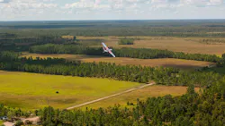
Hosted Feb. 12 at the company’s headquarters in Daytona Beach, Florida, the live operation showcased a 36-mile flight – the first leg of a 79-mile, dual-leg mission successfully completed on Feb. 4, between Daytona Beach and Mims, Florida. The demonstration was designed to showcase aerial intelligence already possible today in United States airspace under existing FAA Part 107 approvals.

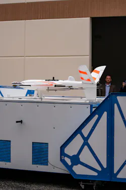
During the demonstration, the Sentaero 6 launched from an automated EdgeDock, transit Class C controlled airspace, crossed major roadways, and flew over populated areas to conduct corridor-scale vegetation management inspections. Equipped with high-precision LiDAR and RGB payloads, the aircraft demonstrated how it captured the critical data needed to secure the modern power grid.
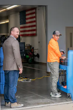
Before the flight, Trevor Perrott, CEO of Censys Technologies, said the company did the mission to prove the breadth, depth and length of what you can do with drones today.
"We are flying through controlled airspace over densely populated areas, crossing major roads, all in a single compliant mission. No new advancements required."
Addressing the Need for Inspections in the Utility Industry
Traditional inspection methods, involving manual truck rolls and short-range drone programs, cannot scale to cover thousands of miles of transmission and distribution corridors, according to the company.
This demonstration reflected a broader shift in how the industry can approach asset intelligence. By combining long-range BVLOS flight, autonomous dock-based operations and onboard data collection using U.S.-manufactured, regulation-aligned uncrewed aircraft, Censys demonstrated how utilities can move from episodic inspections to persistent, corridor-scale monitoring.
The mission illustrated how advanced drone ecosystems can have:
- Reductions in Field Labor: Minimizing reliance on manual inspections and expensive truck rolls.
- Compressed Inspection Cycles: Moving from a traditional 10-year inspection cycle to a 30-day “persistent” view of the grid.
- Enhanced Worker Safety: Removing crews from hazardous environments and high-risk manual climbs.
- Rapid Disaster Recovery: Enabling faster post-storm assessments to restore critical services.
Rather than treating drones as isolated tools, the model demonstrated by Censys represents a networked approach to aerial intelligence designed to operate continuously across regions.
The mission illustrated the complete operational lifecycle — from FAA-approved launch procedures to in-flight data assurance and automated recovery.
For more information, view the video below or check out this TV segment.