The New Wildfire Reality Reshaping Utility Vegetation Management
Key Highlights
- Wildfire risk is expanding across the U.S., affecting regions previously considered low-risk, prompting utilities to rethink vegetation management strategies.
- Traditional cyclical trimming is no longer sufficient; utilities now prioritize risk-based, frequent inspections using remote sensing technologies like drones and satellite imagery.
- Integrated workflows that connect risk detection, field work, and compliance are essential for operational transparency and regulatory accountability.
- Advanced data analytics and real-time monitoring enable utilities to respond proactively to changing vegetation and weather conditions, reducing wildfire liability.
- Long-term investments in technology, system hardening, and undergrounding are transforming wildfire mitigation into a core operational responsibility for utilities.
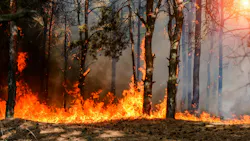
For decades, utility vegetation management programs followed a similar pattern. Patrol the lines. Trim what needs attention. Document the work. Repeat the cycle a few years later.
That model was built around reliability. Utilities wanted to reduce outages, minimize storm-related interruptions and manage vegetation costs across sprawling service territories. It worked reasonably well in a world where wildfire risk was concentrated in a handful of western states and vegetation management was viewed primarily as a reliability function.
That world no longer exists.
Wildfire risk is expanding across the United States, including regions that historically saw little concern about utility-caused fires. At the same time, forests and vegetation are becoming denser. According to U.S. Forest Service data, woody vegetation has increased significantly over the past several decades, creating heavier fuel loads in many regions. Utilities are now confronting a reality where vegetation management is no longer just about keeping trees away from lines. It has become a critical component of wildfire mitigation, operational resilience and financial risk management.
The shift is forcing utilities to rethink how vegetation programs are planned, prioritized and executed.
The Geography of Wildfire Risk Is Changing
In the past, conversations about utility wildfire mitigation centered almost entirely on California and parts of the western United States. But recent fire seasons have shown how quickly that risk profile is changing.
Large fires have increasingly affected states across the Southeast, Midwest and Northeast. New Jersey, Oklahoma, Minnesota and the Carolinas have all experienced significant wildfire activity in recent years. In many cases, the underlying conditions are similar to those that utilities in the West have managed for years: prolonged dry periods, low humidity, high winds and growing development in wildland-urban interface areas.
At the same time, more homes and businesses are being built near heavily vegetated areas, forcing utilities to expand infrastructure into higher-risk territory. That expansion creates more exposure for both utilities and communities.
The consequences are substantial. Utilities are facing rising insurance costs, greater regulatory scrutiny and increasing pressure from investors and credit rating agencies concerned about wildfire liability exposure. In some regions, wildfire risk mitigation spending is now directly affecting customer rates.
For utility leaders, the concern is no longer theoretical. A catastrophic wildfire can create billions of dollars of liability exposure, damage public trust and fundamentally alter a utility's financial outlook.
Why Traditional Trim Cycles Are No Longer Enough
Traditional vegetation management programs were designed around cyclical maintenance. Utilities established trim schedules intended to balance reliability goals with budget constraints. A section of line might be trimmed every three, four or five years, with limited mid-cycle inspections focused on known trouble spots.
The approach made sense when the primary objective was reducing outages caused by tree contact.
Utilities can no longer assume that vegetation conditions remain acceptable between trim cycles, especially in high-risk areas. A rapidly changing environment means risk conditions can evolve much faster than historical programs were designed to address.
As a result, utilities are moving away from broad cycle-based vegetation strategies and toward more dynamic, risk-based programs. That shift fundamentally changes the scale and complexity of vegetation operations.
Instead of treating every span of line equally, utilities are increasingly prioritizing work based on fire risk, vegetation density, weather patterns, terrain conditions and asset vulnerability. That requires more frequent inspections, more granular risk analysis and far more operational coordination than traditional programs demanded.
It also produces a massive increase in data.
The Rise of Persistent Monitoring
One of the biggest changes in utility wildfire mitigation is the growing use of remote sensing technologies.
Satellite imagery, drone inspections, LiDAR scans and aerial patrols are allowing utilities to monitor vegetation conditions far more frequently and at much lower cost than traditional approaches. Companies are using advanced imaging and analytics to identify potential vegetation problems, model fire risk and prioritize mitigation work across large service territories.
This represents a major departure from historical vegetation programs, where inspections often occurred only as part of scheduled trim cycles. Today, utilities increasingly want continuous visibility into changing conditions.
That visibility matters because wildfire risk is rarely caused by a single factor. Vegetation conditions interact with weather, asset health and operational decisions in ways that create highly dynamic risk environments. A line that appears safe one month may become dangerous after a prolonged dry spell combined with high winds.
Some utilities are also adopting practices such as bare-ground pole treatments in areas where assets could spark and ignite surrounding vegetation. Others are combining vegetation intelligence with weather forecasting, wildfire simulation tools and public safety power shut-off planning to manage risk in real time.
Data Alone Does Not Reduce Risk
Identifying vegetation risk is no longer the hardest part. The bigger challenge is managing the operational complexity that comes with this new information.
In many utilities, vegetation risk identification, contractor dispatch, work verification and compliance reporting still occur across disconnected systems, spreadsheets or manual processes. Critical information often moves slowly between departments, contractors and field teams.
This creates operational blind spots at exactly the moment utilities need defensible, auditable processes.
Wildfire mitigation programs require utilities to answer increasingly detailed questions, such as:
- Who identified the risk?
- When was it identified?
- What action was assigned?
- Who completed the work?
- Was the work inspected?
- Can the utility prove mitigation occurred before an incident?
Those questions are important not only to operations, but also to regulators, insurers and legal teams following a wildfire event.
As wildfire exposure grows, utilities are recognizing that vegetation management is no longer simply a maintenance workflow. It is becoming a chain-of-custody issue.
The Operational Shift Utilities are Making
To manage this new environment, utilities are increasingly building integrated workflows that connect risk identification directly to field execution and compliance documentation.
They are combining remote sensing data, field inspections, contractor management, work verification and audit records into centralized operational systems. The goal is to create a clear operational picture, from initial risk identification through mitigation.
The emphasis on documentation is especially important. Utilities are under growing pressure to demonstrate not only that vegetation work was planned, but that it was completed correctly, inspected appropriately and fully traceable. Regulators and insurers increasingly expect detailed records tied to individual assets, spans and work locations.
Maintaining that level of traceability is difficult with fragmented systems or paper-based workflows, especially during major events when utilities must coordinate contractors, prioritize high-risk areas and maintain operational awareness across multiple departments.
Wildfire preparedness now requires the same kind of operational coordination that utilities have historically associated with storm response.
A Long-Term Transformation
Utilities are investing heavily in vegetation management, system hardening, undergrounding projects and operational technologies designed to reduce wildfire risk. In some regions, wildfire mitigation spending has become one of the largest emerging cost drivers facing the industry. But utilities increasingly view those investments as necessary.
The broader reality is that wildfire mitigation is becoming a permanent operational responsibility for utilities across much larger portions of the country than ever before. And while technology continues to improve, there's no single solution that eliminates the risk.
Utilities will still need vegetation programs and field inspections. They will still need contractors, operational coordination and emergency response capabilities. What is changing is the level of precision, visibility and accountability required to manage those programs effectively.
The old model of “patrol, trim, document, repeat” was built for a different era. The next generation of vegetation management will depend on continuous risk awareness, coordinated execution and the ability to prove mitigation work was completed before the next fire starts.
About the Author
Chris Kelly
Chris Kelly is the Vice President of Market Strategy at Arcos, the field operations and workforce management solution provider for utilities and critical infrastructure industries. Prior to its acquisition by Arcos, Chris was the CEO and co-founder of Clearion, a global software company providing vegetation, inspection and maintenance management solutions for the utility industry. During his 30-year career, Chris has developed deep expertise at the intersection of field operations, geospatial technology and sustainability initiatives.