Fulcrum and Woolpert Connect Utility Vegetation Risk Data to the Field Crews
Watch a Demo
Fulcrum, the Field Operations Management platform for almost 3,000 organizations, and Woolpert, which provides architecture, engineering and geospatial (AEG) services for the utility industry, today announced a partnership that connects LiDAR-based vegetation risk data to the field crews who need it, which enables them to take the actions that drive down actual risk.
"Woolpert enables utilities to get vegetation data, but those organizations need a reliable path from a risk score to the crew standing at the right pole," said Mike Lambert, Chief Product Officer, Fulcrum. "This partnership puts that path in place, with field teams getting the best possible outcome at the pole by working off the same prioritized, current picture the office is looking at, and the results feeding straight back into it."
Most power utilities manage transmission and distribution infrastructure without an up-to-date, condition-based view of it, according to the company. That gap forces reactive maintenance: Crews are sent to low-risk spans while encroachment goes undetected elsewhere, outages climb and regulators take notice.
Meanwhile, expectations keep rising — storms shouldn't mean days without power, dry conditions shouldn't mean wildfire risk and utilities are expected to show they're in control of their network, not reacting to it.
Addressing the Needs of Utilities and Their Service Partners
Woolpert's advanced LiDAR and imagery build a connected 3D model of a utility's corridors, scoring vegetation encroachment and clearance risk down to the span and canopy level.
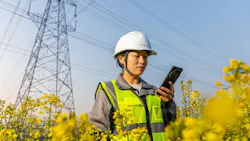
Fulcrum, the platform field organizations use to run, record, and close out their work, takes that scored data into the field. Crews see which spans need attention first, execute the work and close it out with a documented record.
Completed work flows back to Woolpert, closing the loop between what was surveyed, what got done and what's ready for the next compliance cycle.
Instead of giving every span the same attention on the same schedule, the approach prioritizes the highest-risk spans, replacing cycle-based vegetation management with risk-based management.
Clearance documentation and hazard-tree identification, captured as structured data rather than trailing paperwork, cut wildfire and safety exposure for crews and the public and leave utilities with a defensible record when regulators ask for one.
"We built this because managing vegetation risk is a continuous, significant effort that requires a closed loop from observation to action and back again," said Sam Acheson, Market Director, Woolpert. "Bringing Fulcrum into the workflow means the risk we identify from the air turns into documented action on the ground, which generates additional data that further improves risk mitigation."
The Fulcrum-Woolpert integration became live on Sept. 2, and is the first of several anticipated use cases for the companies' combined technology and expertise. The next extension of these capabilities will bring the same LiDAR-to-field-action model to facilities management by verifying clearance between buildings and high-voltage lines.