Would you be surprised to find a LiDAR (Light Detection and Ranging) system in your pocket? If you have one of the iPhone 12/13 Pro or Pro Max, you have it. Apple began using LiDAR to improve its camera’s focusing abilities and it has been noticed by tech sites all over the internet. Apple also included the technology on its iPads.
There are a wide variety of apps in the Apple App Store to turn iPhones and iPads into handheld LiDAR platforms. They perform all the functions of LiDAR’s more sophisticated 3-dimensional (3D) imaging high-end relatives, but on a limited scale. Augmented reality (AR) is benefitting from the addition, and you can see some very interesting YouTube demonstrations for anyone interested.
As more people download these LiDAR apps, the technology is getting into more user hands and user friendliness is increasing. It is a trend that will continue growing and encouraging more innovation. So, expect to see more people chattering about the technical merits of LiDAR technology at a watercooler or coffee shop near you.
Overnight Success
Seriously, the variety of LiDAR applications are growing at a tremendous rate worldwide. When it comes to remote sensing, LiDAR can’t be beat, and the more commonplace it is helps the technology. According to a recent report by Markets and Markets about US$1.1 billion was spent on LiDAR in 2020 and they expect to see it reach US$2.8 billion by 2025. North America is expected to dominate the LiDAR market by region because of environment, corridor mapping, meteorology, and urban planning applications.
The power delivery industry has been a power user of LiDAR technology for several decades, but the use has mainly been with vegetation management and transmission line mapping. It’s interesting many consider LiDAR to be one of those overnight technological success stories. Yet it took decades of hard work and development to accomplish. Before getting deeper into LiDAR, this is a good time to look a little closer at the technology itself.
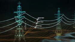
Basically, LiDAR technology is rather straightforward. By definition, LiDAR is an active remote sensing and geospatial system. There are four popular platforms in use today, airborne (aircraft and drones), terrestrial (tripod), mobile (moving vehicles), and handheld.
The LiDAR system consists of a laser emitter/receiver, GPS (global positioning system), and some form of inertial navigation system. The system produces a high density point cloud from the LiDAR surface reflections. The size of the point clouds are massive and can be in the terabyte ranges. It all depends on the resolution of the LiDAR system and the size of the area being mapped.
NERC Alert
LiDAR got a big boost when the North American Reliability Corporation (NERC) issued its NERC Alert of 2010. A few years prior to that there had been a blackout when a tree and line tangled. The root-cause investigation revealed that transmission lines were not always built according to engineering designs. Further investigations lead to the fact it was a common problem within the grid.
NERC was not a happy camper. As a result, all utilities within their jurisdiction had to identify possible discrepancies between design and actual field conditions for all transmission lines 100 kilovolt (kV) and above. Turns out there were more than 450,000 miles (724,205 km) of transmission lines in that classification.
Initially, NERC gave the utilities six months to do it, but relented when complaints mounted, and there were lots of them. NERC ended up breaking the task up into High, Medium, and Low Risk categories. Each category had to be done by a certain time with the Low Risk lines not being completed till somewhere around 2015.
There was an interesting footnote on the Alert. It said, “Fortunately, new technologies such as LiDAR and PLS-CAD allow entities to more easily assess their lines.” How did these two applications succeed with the task? Talking with Otto Lynch, president, and CEO of Power Line Systems gave some interesting insights to the incident.
Lynch said, “As a result of the NERC Alert, 80% of the 100 kV and greater transmission lines in the U.S. were modeled using PLS-CADD. To help with this immense amount of work, Power Line Systems developed LiDAR tools to import LiDAR data directly into the PLS-CADD models speeding up the entire process.”
Lynch continued, “PLS-CAD looks at the LiDAR point cloud and intelligently identifies (classify) the ground points, wire points, and structure points. From those points, it then finds the structure point centers (i.e. structure locations). At that stage, PLS-CADD looks at the wire points and fit catenaries through them. PLS-CADD then finds the attachment points (i.e. where the catenaries intersect).”
Lynch went on to explain, “Unfortunately LiDAR can’t pick up the type of conductors (yet), so this has to be selected by human intervention. PLS-CADD does use a default conductor for every automatically found catenary. If the user knows the type of conductor before starting, then it is added, and that part is done.”
Lynch pointed out that the user can put all conductor information in a table and PLS-CADD can perform rapid sorting and copy/paste functions. There is also a graphical option allowing the user to click on each wire and change it out. In effect, using these algorithms and other computational aids to interpret LiDAR data redefined utility inspections and mapping, but there was more to come in this evolution.
Advancing Technology
In one innovative application, LiDAR is being used for a dynamic line ratings (DLRs) system. LineVision and Velodyne have signed an agreement to help improve transmission line operations. LineVision uses Velodyne’s LiDAR sensors along with advanced analytics in its V3 overhead powerline monitoring system. The LiDAR sensors monitor the line’s conductors and surrounding environment in specific locations and the V3 provides DLRs in real-time.
Another state-of-the-art LiDAR application monitors the wind for wind turbines. LiDAR data is fed into a wind modeling application to improve the output generation of wind turbines. Knowing the wind characteristics (speed, direction, turbulence, etc.) in front of the turbine blades can improve the efficient operation of the turbine and its power output. Epsiline’s WindEagle system uses LiDAR and algorithms to measure the wind characteristics 10m (33ft) in front of the turbine, which improves the actual performance of the wind farm.
LIdar and Twins
LiDAR quickly transforms everything it scans into digital data, which in turn makes a virtual digital copy of the physical world. This is revolutionary way to see the world has led to a technology known as a digital twin. Think of a digital twin as a bridge between the physical world and virtual reality. Digital twins have been a hot topic for several years, but again the technology dates back many years.
Last year, Otto Lynch discussed digital twins in an article for “Charging Ahead. He said, “PLS-CADD was a digital twin long before the term had been coined.” For the complete story, see “So What Is Industry 4.0” in the August 2020 (https://tdworld.com/21135550) T&D World.
The digital twin technology makes it possible to vary physical conditions (i.e., line loadings and weather) and see the correlation between the conductor movement and vegetation encroachment. These simulations allow various scenarios to be applied to the grid without endangering it.
A recent press release reported that TasNetworks contracted with Fugro to develop a 3D virtual model (digital twin) of the power network in Tasmania, Australia. Fugro will create the digital twin using aerial LiDAR and imagery data. They will process the data using state-of-the-art machine learning and cloud computing systems. TasNetworks reports, “They will be able to analyze the data, and execute detailed engineering and vegetation clearance analysis using Fugro’s cloud-based platform.”
Posterchild of Big Data
When LiDAR systems gather data they do it extremely fast, which is one of LiDAR’s major advantages, but there is a price. The size of that data is massive and unstructured, which is LiDAR’s major disadvantage. The files are so large they are called big-data, and can’t be processed using traditional methods. Thanks to advancements in digital technology they don’t have to be.
Big-data needs a different approach. Deep learning, machine learning, and other artificial intelligence (AI) applications fit the bill perfectly. Companies like ArcGIS, Enview, IBM, Leidos, Power Line Systems, and others have developed AI tools that can autonomously process data, identify and label the assets of interest such as the structures, conductors, and vegetation for transmission and distribution lines.
These AI offshoots quickly reduce the tedious manual labor associated with processing point cloud data, by identifying physical objects and threats to those assets in the point cloud. It’s making LiDAR applications more user friendly than ever before.
There is no limit to the various ways utilities and their decision makers can use these smart applications when combined with asset management and work management. Tools like theses prove that old axiom about what was once a tech-toy is now a technological necessity!
About the Author
Gene Wolf
Technical Editor
Gene Wolf has been designing and building substations and other high technology facilities for over 32 years. He received his BSEE from Wichita State University. He received his MSEE from New Mexico State University. He is a registered professional engineer in the states of California and New Mexico. He started his career as a substation engineer for Kansas Gas and Electric, retired as the Principal Engineer of Stations for Public Service Company of New Mexico recently, and founded Lone Wolf Engineering, LLC an engineering consulting company.
Gene is widely recognized as a technical leader in the electric power industry. Gene is a fellow of the IEEE. He is the former Chairman of the IEEE PES T&D Committee. He has held the position of the Chairman of the HVDC & FACTS Subcommittee and membership in many T&D working groups. Gene is also active in renewable energy. He sponsored the formation of the “Integration of Renewable Energy into the Transmission & Distribution Grids” subcommittee and the “Intelligent Grid Transmission and Distribution” subcommittee within the Transmission and Distribution committee.