Drones Aid in Remote Monitoring of Power Plant Assets
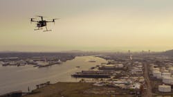
In the past few years, drones have emerged as an essential tool in the energy sector for monitoring and surveilling power plant assets such as buildings, equipment, and other systems that ensure safe, efficient operations. Today, inspectors use drones to monitor thermal, nuclear, hydroelectric, wind, and solar assets more safely and often in less time when compared with traditional inspection and other remote monitoring methods.
In addition to safety and efficiency, drones also allow for more frequent monitoring. Not only are they an ideal choice for time-critical inspections, but they also enable more strategic planned maintenance. Inspection data can even be sent to a smartphone app, allowing maintenance personnel to easily triage and route issues directly from the site.
Drones are being used to remotely monitor boilers, fuel storage tanks, transmission lines, turbines, smokestacks, pipelines, fish ladders, solar farms, and more. Drones aren’t always the ideal choice, especially in certain confined spaces in power plants — lack of proper lighting, color nuances, radio signal reflection, and propeller turbulence can all affect a drone’s performance. Powerful LED lamps attached to the drone can improve image quality.
Public Utilities
Public utilities have much to gain from drone adoption. In the United States alone, there are 600,000 miles of high-voltage transmission lines and 5.5 million miles of distribution lines that need periodic inspection. Using drones, inspectors can complete detailed inspections of up to five to six miles of transmission lines and distribution poles per day, capturing both thermal and RGB imagery, while substation inspections can be completed within an hour. Additionally, drones can capture survey-grade maps for siting transmission lines and pipelines.
On the natural gas side, there are an estimated 2.4 million miles of underground natural gas pipeline across the country. Pipeline leak detection is now being performed via drones mounted with thermal imaging sensors.
A small unmanned aircraft can be used to assess the exterior of a reactor building in two days, providing high-quality data and reducing the cost of surveys, which would typically require a crane and about a week of work. Further, eliminating the need for a crane keeps the crew on the ground.
Drones can also provide the following remote monitoring capabilities for coal and thermal power operations:
- Visual inspection of the boilers, turbines, and generators
- Coal stockpile volume calculation
- Smokestack inspections
- Substation equipment inspections
Solar Energy
As for solar energy, there are 6000-plus utility-scale solar facilities nationwide that require regular inspections. Drones can detect a malfunctioning panel far more quickly than a field crew on foot. For commissioning, warranty, or regular maintenance, drone inspections are 95% more efficient and can identify defects, track misalignment, shading, tower, and substation conditions that manual inspections might miss. Drone inspections take less than 10 minutes per megawatt and save, on average, US$1200 per megawatt in costs, with larger sites saving more.
Using an unmanned aerial system (UAS), a West Coast solar utility has dramatically cut the time required for site assessing new, energy-maximizing locales for their utility-scale solar farms. The sensors they use also provide more robust geographic information systems (GIS) and orthoimagery data that improve the end design of the plant. They can create 3D visualizations, better analyze construction costs, and optimize placement of ground-mounted photovoltaic (PV) panels so they generate the most energy.
This solar company found that a manual site assessment for a 500-kW site takes two technicians up to two days, while a 40-minute drone flight can map a 1-MW site. A program that begins with inspections can grow to help with inventory management and then to 3D modeling and site mapping.
Wind Power
There are also some 52,000 utility-scale wind turbines operating in the United States and an estimated 800,000-plus turbine blades worldwide that need regular inspection. Drones eliminate much of the climbing associated with this work. With demonstrated inspection time of 15 to 30 minutes per turbine, drones reduce man-hours and turbine downtime for maintenance checks by over 75%.
Drones equipped with a high-resolution camera perform preventive maintenance inspections on wind turbines, allowing crews to locate and photograph fissures and other abnormalities on blades, rotor hubs, or the tower itself. Drones can also inspect after natural disasters and weather incidents such as lightning strikes. Class 5 damage, such as a lightning strike at the blade tip, can lead to an efficiency loss of 6% to 8% — and a 500% increase in failure rate. It’s critical to investigate damage quickly in order to reduce energy loss.
Hydroelectric Energy
Hydroelectric power stations are currently the largest renewable source of energy in the United States, but the second in nominal capacity (behind wind power). Hydroelectric power produced 35% of the total renewable electricity in the United States in 2015 and 6.1% of total U.S. electricity. Currently, hydroelectric stations exist in at least 34 U.S. states.
Regular inspections of a dam’s exterior features are crucial to the safety and integrity of the dam, including spillway gates, tunnels, downstream slopes, surge tanks, and remote locations on penstocks. Before drones, engineering operations would perform rope-access inspections to inspect the entire dam face for cracks, joint offsets, concrete damage, gate misalignment, and overall condition. These tasks now can largely fall to drones, as well as fish ladder monitoring, aerial photography, construction monitoring, monitoring of dam during flood inspections, and lock miter gate inspections.
New Insights from Data Not Being Captured Before
Drones can improve the quality of information they supply to their many stakeholders and partners. LiDAR sensors mounted onto drones have improved surveying efficiency and accuracy. Infrared thermal sensors find HVAC energy efficiency opportunities. They now capture cloud points that are incorporated into building information modeling software and provided to architects.
Photogrammetry is providing valuable data of site monitoring to superintendents, and power plant, solar farm, and dam managers. They can supply cardinal direction views for 3D models, training, informational videos, and more.
Power companies are also investing in software to turn data collected by drones (photographic, GIS, thermal, and infrared) into actionable intelligence and software to better maintain their drone fleets, its flight information, FAA licensing, and flight permissions.
With the gains they bring in cost, reliability of critical energy and water infrastructure, safety and decreased business risk, the time when drones are a facet of everyday operations for energy and utility companies is now.
About the Author
Mimy Indra
Mimy Indra is director of client strategy and business development at Skyward, a Verizon company. Indra consults with major enterprises on all phases of UAS operations, including calculating ROI, identifying priority uses for corporations, training, and more.