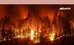
The growing frequency and intensity of wildfires in the US have pushed electric utilities to look for new and innovative wildfire and risk mitigation strategies. Even today, it remains a complicated and staggering challenge for utility companies to streamline prevention, detection and response of wildfires effectively.
AiDash, a San Francisco Bay Area-based leading satellite analytics company, has released its first White Paper titled "Wildfire Mitigation Best Practices for Electric Utilities" This paper highlights the causes, effects and real-world solutions for electric utilities that can help mitigate wildfires while reducing costs and improving reliability.
The role of electric utilities in wildfire ignitions
Fallen power lines are one of the top causes of wildfire ignitions in the US. Besides burning large areas of land and polluting the environment, wildfires inadvertently lead to mass-scale power outages.
Utility operators are also forced to roll blackouts as a preventative measure in wildfire-prone areas, causing customer dissatisfaction. The revenue loss, wildfire liabilities and poor reliability have affected utility businesses across the country.
Often high winds cause tree branches and debris to fall on powerlines sparking fires in the process. In any case, untrimmed vegetation and utility infrastructure are a dangerous combination and must be kept away from each other.
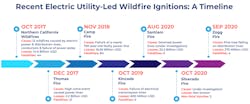
Not all fires caused due to natural factors can be prevented, but the ones related to vegetation can and must be stopped. Recent years have witnessed a lot of fire occurrences due to vegetation and even faulty infrastructure. The most significant fire in California history, the Camp Fire, was a result of faulty infrastructure. It caused a major utility company to file for bankruptcy and incur losses up to a whopping 30 billion USD.
Empowering utilities with satellite technology
Utilities have used helicopters, drones and LiDAR in the recent past, but to no avail.
Satellites are already revolutionizing the vegetation management space and enabling utilities with complete control over their operations and maintenance of geographically distributed assets. Satellites are ten times cheaper than drones or LiDAR. Their information gathering speed is instantaneous and they are the utility industry's best bet for wildfire mitigation.
Here's how AiDash is enabling utilities with satellite and AI-powered technology to mitigate wildfire risks:
- AiDash Intelligent Vegetation Management System (IVMS) is already enabling large Fortune 500 utility companies to reduce costs by 20% and improve reliability by 15%. Any electric utility company's wildfire mitigation strategy and vegetation management must go hand-in-hand for the best results.
- AiDash Remote Monitoring & Survey System is exclusively designed for power utilities. It provides stakeholders complete visibility of their Transmission and Distribution Lines, including vegetation hazards, RoW encroachments, wildfire risks and weather-related damage. It empowers them with the control they need for proactive and preventive operations and maintenance.
Satellite analytics coupled with AI-powered models like the Digital Elevation Model, Super Resolution Model and more help predict vegetation growth rate around power lines, detecting vertical clearance between power lines and trees map distances between hazard and distribution line computed against actual hazard tree height. Satellites have inbuilt high-resolution sensors that help in generating high-resolution imagery.
Additionally, SAR-equipped satellites are light and weather independent and can detect the tiniest encroachments and sparks from up in space. Thus, proving to be very effective in terms of wildfire mitigation.
DOWNLOAD THE WHITE PAPER NOW to gain deep insights into the newest, most innovative strategies and technologies and the emerging best practices for wildfire mitigation tailor-made for electric utilities.
Sponsored by:


