Don’t Just Get the Tree, Get the Right Tree
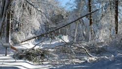
Hazard trees are becoming a greater problem in utility vegetation management (UVM). Tree health is declining amid threats from rising temperatures, invasive pests, fungal pathogens and worsening and more frequent severe weather events.
Hazard trees increase customer service interruptions, reduce reliability and lead to rising removal expenses for utilities. Beyond hazard tree removal costs, there are heightened worker safety concerns.
Meanwhile, UVM budgets are flat or shrinking. And although fall-ins account for up to 70% of outages, hazard tree programs typically get only about 20% of vegetation management (VM) budgets.
Budgets must stretch further than ever despite these rising threats; in other words, UVM programs need to achieve more with fewer resources.
Fixed, time-based trim cycles are no longer sufficient. The industry needs to pivot to a dynamic condition-based cycle trim and a risk-based hotspotting program to addressing hazard trees and improving reliability. Instead of just cutting trees, utilities need to cut the right trees on the right segment at the right times. This requires both a mindset shift and a process shift — from a reactive approach to a proactive one.
In order to know where to prioritize resources, utilities need more information. Fortunately, as older traditional methods of managing vegetation prove unsustainable, powerful technological solutions have emerged to help utilities meet these challenges.
Remote sensing, using a satellite-first approach, lets utilities cut back hazard trees based on priority instead of time. Hazard tree mitigation is closely tied to asset inspection, too. If every asset is inspected with the right remote sensing technology, at the right frequency, and problem areas are addressed quickly, utility-caused fires and outages can be drastically reduced, if not eliminated.
The benefits of a pivot to a condition-based approach are manifold. Utilities can improve grid reliability, reduce customer interruptions, get better results from their O&M spend, comply better with regulations — and feel like they’re finally getting ahead.
Proactive Instead of Reactive
Without a condition-based trim program, utilities are inherently in a reactive role: When there is a problem, they react. Even hotspotting between cycle trim periods, as it’s typically performed, is fundamentally reactive. Though hotspotting is tactical, managers send crews out to focus on an area only after there have been a number of outages on a feeder.
Working from a reactive mode means utilities are constantly chasing down issues as they happen; what’s lost is prevention. It’s impossible to find and mitigate every hazard tree, but the industry can do better — and improve reliability by severely limiting vegetation-caused outages through improved identification and targeted, tactical, surgical trimming.
Fundamentally, a shift towards condition-based trimming is a shift towards proactive trimming. If utilities know where the hazard trees are across their whole network, have insight into the condition they’re in and understand the context (assets, soil, terrain, etc.), they can prioritize according to the greatest risk.
Why Satellite-First?
A satellite-first approach is the best method for utilities to transition to a condition-based trim program, allowing them to proactively target hazard trees.
It's satellite-first because there are multiple ways to scan utility networks. Each method has advantages and limitations. The most effective approach is to combine their benefits in a complementary way.
For example, manual boots-on-the-ground inspections are thorough. But they’re inherently slow and expensive. And they might miss some issues, because a tree may not appear to be dying until it’s dead. It can be difficult to spot weakened root conditions, infestations or stem damage from heart-rot diseases during manual inspections.
LiDAR offers incredible precision when utilities need to determine factors like radial clearances and pole heights. But it’s typically too expensive to perform LiDAR scans with sufficient frequency, and in many cases, it’s cost-prohibitive for a utility to use LiDAR to scan their entire network. Further, although LiDAR can easily identify split trunks and weak tops, it can’t measure every aspect of tree health.
Both manual in-person inspections and LiDAR have another shared limitation: they struggle to identify trees that are outside the right-of-way (ROW) that are still tall enough to pose a fall-in risk.
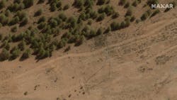
Remote sensing with satellite imagery is a fast, precise (circuit-level accuracy of greater than 90%), and cost-effective way to assess large areas. Satellites use multispectral imagery to detect tree health, making it ideal for large-scale hazard tree detection. And satellites can easily capture imagery 300+ ft outside of the ROW, thus solving the problem of identifying hazard trees that are further away from power lines but still pose potential fall-in risks.
Because satellite imagery is comparatively more cost-effective, utilities can scan their entire network every year. And in between full scans, they can use satellite imagery to do spot checks on smaller segments of their network, especially if there’s an acute cause for concern, such as storm damage or wildfire risk.
All of these methods are complementary. For example, where satellites flag an area of high risk, utilities can perform an on-the-ground inspection to estimate and plan mitigation work. In areas of low risk, satellite-only inspections may suffice, so utilities don’t have to spend the money on an in-person inspection at all. And in areas that are difficult to access by foot, satellite imagery can provide critical insights without the risk and expense of sending out crews.
Because remotely detecting vegetation encroachment and hazard trees requires accurate pole location, height and construction information, utilities can update and correct this data by combining satellite imagery with LiDAR scans.
By leading with satellites and complementing them with ground-based LiDAR and on-ground patrols, utilities can achieve what no single data source could — and do it more cost-effectively.
Empowered By Software
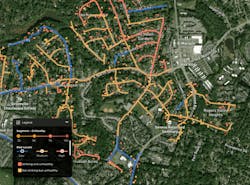
Fundamentally, utilities need visibility into the condition of their networks and insights into what to do about what they find. In addition to acquiring a full scan of the network, utilities need a software platform to make sense of all the remote sensing data and manual inspection reporting, offer actionable recommendations and provide a single source of truth through which it all runs.
For example, a capable software platform allows utilities to create a hazard tree inventory backlog with criticality analysis, so they can make calculated decisions about trim prioritization, rather than abiding by a first-in, first-out approach.
Software provides automated workflows that enable utilities to analyze, plan and execute vegetation management activities from a central hub, communicating directly with field staff and contractors using a field application.
When utilities are evaluating software vendors to facilitate a satellite-first hazard tree program, they should consider these factors:
- Can the vendor fuse satellite data with other data sources like LiDAR, aerial imaging and boots on the ground to provide the most accurate and cost-effective data for VM purposes?
- Can the vendor perform cost-effective, lightweight asset conflation to correct inaccurate pole location, height or construction type information?
- Can the vendor’s software turn analysis into an actual work plan their crews can execute?
- Does the vendor provide high-precision hazard tree detection, minimizing false positives that could lead to wasted inspection costs?
Success Stories from the Field
These capabilities are not theoretical; they’re available now. Utilities are already using this satellite-first approach to achieve real results in their vegetation management programs.
They’ve been able to become more systematic in running their programs, achieve higher accuracy with hazard tree identification, become more agile and creative, achieve O&M efficiencies and plan trim programs years ahead.
Here are some real-life examples from AiDASH customers:
A Fortune 500 utility in the western United States faced new challenges beyond general management of its tens of thousands of line miles. The combination of drought conditions and invasive pests led to tree deaths that happened faster than their time-based trim cycle could track. And severe storms made weakened, sick and dying trees all the more hazardous.
They found that they didn’t have adequate visibility or efficiency to meet annual trimming goals. As a result, costs increased, and reliability decreased. The utility needed to step up identification efforts, collecting the data on wire zones and border zones to assess tree health and determine where to act. A satellite-first strategy helped them better understand where in the future these dead or dying trees were going to be.
A large Northeast IOU has seen a 30% decline in tree-related events, a 38% reduction in tree-related customers interrupted and a 55% reduction in tree-related customer minutes interrupted in the year after circuits were pruned.
They’ve achieved $1 million in avoided cost, with technology removing the need for time-consuming manual processes like field reviews to determine if a circuit needs to be pruned. They’ve also realized $2 million in efficiencies in the first few years of adopting the Intelligent Vegetation Management System (IVMS), as they were able to defer some circuits the beyond the standard five-year cycle. In addition, they developed variable cycle lengths for their entire network, which allows them to be even more efficient about addressing each part of the network.
An IOU in the Northwest reduced their reliance on traditional field assessments and adopted IVMS as a single, web-based solution that brought together multiple data sources, allowing crews to access up-to-date and accurate information daily. It reduced the potential for user errors during data collection and allowed them to identify high-risk areas more effectively.
A co-op in the Great Lakes region was able to develop a system inventory with clear and actionable data, making it easier to allocate resources effectively. The systematic approach to maintenance helped them increase their operational efficiency, and they reduced the risk of outages and improved overall system reliability.
And the data-driven approach gave the team the credibility they needed to advocate for necessary budget increases and systemic changes.
A large IOU in the Southeast moved from a strictly feeder-based segmentation to a segment-based program, allowing them to prioritize which segments on their systems need the most attention. Because they're able to look at growth rate by segment, they're able to budget years ahead.
An IOU in the Southwest was able to reclaim 7.7% of their O&M budget across the area in their IVMS pilot program. They then reallocated those funds to critical areas.
Getting Ahead
The growing challenges around hazard tree mitigation can make utility vegetation managers feel constantly bogged down and trying to keep up, chasing down outages as they come and never able to get ahead of the threats.
That’s fundamentally a reactive stance — one that’s becoming increasingly difficult to maintain in the face of flat or shrinking budgets, increasing costs, severe weather events and more volatile and unpredictable vegetation-related threats.
But as old, established methods of managing vegetation prove unsustainable, powerful satellite-first technological solutions have emerged to help utilities meet these challenges, improve reliability and shift to a condition-based, proactive, tactical approach to hazard tree mitigation — and UVM overall.
About the Author
Abhishek Singh
Abhishek Vinod Singh ([email protected]) is CEO and cofounder of AiDash. An alumnus of I.I.T. Kanpur, Abhishek worked with many IT companies prior to starting and growing a series of successful tech businesses including DbyDx Software & Edureka. He is based in Santa Clara, California.


