Modernizing Vegetation Management: How Westerville Electric Divided Embraced Data-Driven Solutions
Key Highlights
- Westerville Electric Division reduced vegetation-related outages by 41% through proactive, data-driven vegetation management strategies.
- The utility integrated satellite imagery and AI analytics with existing GIS systems to enable real-time risk assessment and decision-making.
- Transitioning from manual processes to digital workflows improved operational efficiency, reduced errors, and enhanced crew safety.
- Predictive analytics allowed for better resource allocation, prioritizing high-risk areas and preventing costly emergency repairs.
- The case demonstrates the importance of modern technology adoption in municipal utilities to meet increasing vegetation and climate challenges.
Municipal-owned electric utilities play a vital role in society. Unlike investor-owned utilities, which balance shareholder interests with service delivery, public power utilities operate with one clear mission: delivering high-quality service and value to the communities they serve for the long term. Their focus is on meeting the unique needs of their customers, providing safe, reliable electricity at affordable rates.
To uphold their public service obligations and maintain customer satisfaction, municipal utilities must minimize outages and maximize operational efficiency. Vegetation management (VM) plays a crucial role in this mission. Overgrown or hazardous trees near power lines are among the leading causes of service disruptions and safety hazards. As the impact of climate change intensifies, effective VM becomes even more critical for grid reliability. Yet, many municipal utilities face significant hurdles in modernizing their operations to meet these growing challenges.
Many still rely on traditional, labor-intensive VM methods that are costly, time-consuming and prone to human error. Compared to their investor-owned counterparts, municipal utilities tend to adopt new technologies more slowly, constrained by bureaucratic processes, political oversight and limited funding for major capital projects. Without profit-driven incentives, operational efficiency improvements are not always a top priority. However, the landscape is shifting, and an increasing number of municipal utilities are embracing innovative solutions to enhance reliability and efficiency.
One such example is the Westerville Electric Division in Westerville, Ohio. Serving more than 40,000 residents, Westerville turned to innovation to improve service reliability and operational efficiency. Confronted with budget constraints, growing regulatory demands and increasing vegetation risks, the utility pursued a more advanced approach to vegetation management. By using satellite imagery and AI-driven analytics, Westerville successfully reduced vegetation-related outages by 41%, optimized resource allocation and strengthened grid resilience.
This case study explores how Westerville implemented a data-driven strategy and provides insights for other municipal utilities looking to modernize their approach to vegetation management.
The Challenge
Westerville Electric Division faced significant challenges in managing vegetation along its power lines, largely due to outdated, manual processes. These issues not only hindered operational efficiency but also increased the risk of vegetation-related outages.
A major obstacle was the reliance on manual work management. Westerville used paper maps and outdated record-keeping, leading to inefficiencies and slow response times to vegetation-related issues. Field crews worked with fragmented data, making it difficult to track maintenance progress or address areas of concern promptly. This method resulted in errors, duplicated efforts and missed opportunities for optimization.
The division’s reactive maintenance approach further compounded these issues. Previously, Westerville relied on biannual aerial imagery and customer-reported problems as the main sources of information to identify vegetation risks. While this provided some oversight, it was insufficient and far from ideal, leaving little time for corrective action when risks were identified. By the time issues were spotted, the risk of an outage had already escalated.
The utility also faced workforce challenges. As experienced employees retired or transitioned out of the workforce, much of their valuable institutional knowledge, such as insights into vegetation growth patterns and critical areas of concern, was at risk of being lost. This posed a challenge in maintaining operational continuity and ensuring that new employees could access the knowledge needed to effectively manage the utility’s infrastructure.
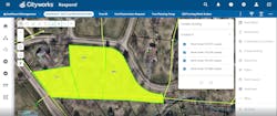
Finally, Westerville experienced data silos due to unharmonized systems and processes. Although the utility used Cityworks for work planning, it lacked a single source of truth for all relevant data. This complicated decision-making, leading to inefficiencies and missed opportunities for improved performance.
The Game Plan
The Westerville Electric Division set out to transform its VM program by adopting a data-driven strategy. Recognizing that the current methods employed left the grid vulnerable to outages, the utility sought a more advanced approach—one that would identify and address vegetation risks before they could disrupt service. This shift aimed not only to enhance grid reliability but also to improve operational efficiency and better prepare for the challenges posed by severe weather.
Five Lessons for Utility Vegetation Managers
Westerville’s success story underscores several key takeaways for vegetation managers looking to modernize their programs:
- Shift to condition-based maintenance: Transitioning from a cycle-based approach to a condition-based maintenance strategy using satellite intelligence allows utilities to focus on addressing risks as they emerge, reducing outages and improving grid reliability by taking action based on actual vegetation conditions rather than a fixed schedule.
- Optimize resource allocation with risk-based prioritization: Prioritizing high-risk areas based on data-driven insights helps utilities allocate resources effectively, ensuring that the most critical issues are addressed first while minimizing unnecessary spending.
- Seamlessly integrate systems for better data sharing and decision-making: Integrating satellite-based monitoring tools with existing systems enables utilities to consolidate data from multiple sources. This integration streamlines decision-making, improves coordination across teams and ensures that everyone has access to the most up-to-date insights, which is key for faster response times and more efficient operations.
- Enhance operational continuity with knowledge retention: Implementing digital systems that centralize data and insights ensures that valuable institutional knowledge is preserved and accessible, reducing risks associated with workforce turnover and enhancing long-term operational continuity.
- Increase stakeholder buy-in with data-backed results: Demonstrating the effectiveness of new technologies with clear, data-backed results not only justifies investments in modern vegetation management but also helps secure ongoing support from stakeholders, such as city councils, utility boards and customers.
A key focus of this transformation was the transition from reactive to proactive maintenance. By moving toward prevention, Westerville could reduce the likelihood of outages and improve grid reliability. In addition to proactive measures, enhanced digital integration was a top priority. The utility recognized the need to integrate various platforms and systems to enable real-time data sharing, which would streamline decision-making processes.
Another key goal was to streamline field operations. The utility sought to improve task delegation and optimize fieldwork by implementing digital tools that would allow progress to be tracked in real-time. This included the use of digital records to ensure accurate documentation, improve cost management and minimize errors that often occur with paper-based systems.
Additionally, Westerville aimed to create greater transparency across its operations. Moving away from paper-based systems and instituting robust digital record-keeping would help the utility better track ongoing vegetation management efforts, facilitating more accurate future planning. This shift would also reduce the reliance on manual data entry, making it easier for teams to monitor progress, identify trends and make data-backed decisions that would enhance long-term vegetation management strategies.
Harnessing Satellite and AI
To address the challenges of traditional VM, Westerville Electric Division implemented LiveEO’s Treeline solution, which leverages satellite technology and AI-driven analytics to enhance grid reliability and operational efficiency.
Key aspects included:
- Encroachment and Fall-In Risk Analysis. Using high-resolution satellite imagery and AI-powered insights, Treeline identified trees posing a risk of encroachment or potential fall-in along power lines. This allowed Westerville to take preventative action before issues escalated, significantly reducing emergency maintenance needs and vegetation-related outages.
- Vitality Assessments. Advanced analytics provided real-time insights into vegetation health, helping Westerville detect hazard trees — or unhealthy vegetation within, or outside the right-of-way (ROW) that have the potential to fall within electrical clearance zones — before they became safety risks. This not only improved the effectiveness of maintenance operations but also enhanced crew safety by prioritizing the most critical areas.
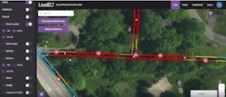
- Predictive Analytics. Treeline’s AI-driven forecasting tools helped Westerville anticipate vegetation risks, enabling more efficient resource allocation. By identifying high-risk areas in advance, the utility could prioritize maintenance efforts, optimize budgets and prevent costly emergency interventions. Seamless Integration with Esri GIS. Treeline’s integration with Westerville’s existing system allowed for a centralized, real-time view of vegetation risks. This streamlined work management, facilitated data-driven decision-making, and ensured that crews had immediate access to critical insights, improving response times and operational efficiency.
The Outcome
Westerville’s shift to a data-driven, satellite-based vegetation management approach improved grid reliability, optimized resource allocation and enhanced operational efficiency.
- Fewer Outages: Westerville achieved a 41% reduction in tree-related outages between 2023 and 2024. By identifying high-risk areas in advance, the utility was able to address potential hazards before they disrupted service. This not only improved grid reliability but also reduced the number of customers affected by outages by half, enhancing overall satisfaction.
- Smarter Budgeting: With better data visibility, Westerville could forecast costs more accurately and allocate budgets more efficiently. Predictive analytics helped the utility prioritize high-risk areas, reducing the need for costly emergency maintenance. By demonstrating clear ROI, Westerville was able to justify budget increases for proactive vegetation management, ensuring long-term sustainability.
- Data-Driven Decision-Making: The real-time monitoring and analytics provided by Treeline allowed Westerville to move beyond reactive maintenance and take a strategic, risk-based approach. With clear insights into vegetation growth patterns, potential hazards and maintenance priorities, the utility could optimize work planning, allocate resources more effectively, and improve long-term risk mitigation.
- Streamlined Operations: The integration of Treeline with Esri GIS and Cityworks eliminated cumbersome manual processes, allowing for real-time data sharing and faster response times. Field teams had access to up-to-date insights, enabling them to execute tasks with greater precision and accountability. Digital workflows reduced inefficiencies, ensuring that maintenance efforts were well-coordinated and that every action taken contributed to the utility’s broader reliability goals.
By harnessing the power of satellite data and AI, Westerville Electric Division turned meaningful insights into tangible results, setting a new standard for municipal utility VM.
The power grid is facing increasing threats from vegetation encroachment, but advanced satellite-based monitoring offers a viable solution. As the Westerville case demonstrates, leveraging satellite data and AI-driven analysis can lead to substantial reliability improvements, helping utilities maintain service continuity and reduce costs.
About the Author
Joe DeLong
Joe DeLong ([email protected]) is a utility forester for the City of Westerville Electric Division. As an ISA Certified Arborist and ISA Utility Specialist, Joe has dedicated more than a decade to the industry, beginning in 2010 as a grounds person and becoming a skilled tree climber. He manages a team of utility arborists and oversees vegetation contractors. Throughout his career, Joe has been driven by a passion for safety, efficiency and enjoyment in the workplace. He believes in making the challenging tasks of vegetation management as safe, streamlined, and enjoyable as possible for himself and his team.


