Technology Advances a Tropical Country's VM
Often caused by contacts between wires and trees, unintentional outages of distribution networks impact consumers. Such outages are more common in areas with high-density vegetation, such as the rural areas of tropical countries. These outages negatively impact the system average interruption duration index (SAIDI) and system average interruption frequency index (SAIFI) reliability indicators, especially when regulatory agencies have established increasingly demanding thresholds. Utilities facing such challenges oftentimes explore alternatives that will improve the reliability indicators directly and enable efficient operation of the distribution system so it is profitable.
Empresas Públicas de Medellín E.S.P. (EPM), a Colombian public service utility, manages more than 45,000 km (27,962 miles) of distribution lines at 13.2 kV and 44 kV in the Antioquia region. Because of the geographical conditions of Antioquia, many distribution circuits are in rural areas with a high penetration of vegetation that make them difficult to access. The unwanted contact between the distribution networks and the forest cover surrounding them, especially for rural circuits, is one of the main causes of outages. As a result, in recent years, EPM has had to compensate consumers for nonfulfillment of electricity, based on the reliability indices, which has added up to hundreds of thousands of dollars.
To change this, EPM recently conducted a study analyzing the technical feasibility of capturing spatial information by drones using light detection and ranging (LiDAR) technology. By considering the conditions of its network and the geography of Colombia, the utility aimed to develop a contact-risk analysis between vegetation and hard-to-access distribution networks. EPM combined advanced analytics with a financial viability study considering the impacts, costs and benefits of implementing LiDAR technology.
Identifying Trimming Sites
Currently, the identification of sites that require vegetation control, like trimming, is performed through visual paths through the network corridors. This method is imprecise because maintenance crews perform the activity. Strictly using their discretion, crews evaluate the risk of vegetation in proximity to the energized network and, thus, select the locations for trimming. In addition to this inaccuracy, this inspection activity may represent physical risks for field personnel because of irregularities in the terrain during long journeys.
By using LiDAR information obtained by drones to determine the distance between vegetation and distribution networks, the utility seeks to leverage advanced analytics to precisely identify which sites need trimming, not only reducing the time required to identify sites but also the risks associated with this activity. Currently, about 80% of the value of economic compensations for vegetation contact is caused by only 87 circuits out of 963, or 9% of all circuits, in operation by EPM. Therefore, the utility narrowed its focus on the LiDAR alternative to those 87 circuits.
Pilot Project
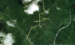
Using unmanned aircraft with LiDAR, in conjunction with data analytics, to obtain and process spatial information on vegetation and infrastructure in electricity distribution corridors may be common in countries such as the U.S., Spain and Chile, but it was new to EPM. Therefore, the utility wanted to do a pilot project with one of its circuits, particularly to validate the use of the technology within the geographic conditions of Colombia. The utility felt this would help to reduce uncertainties before using the technology more widespread. The length of the section studied was 6.4 km (4 miles) and located in a rural area of the municipality of San Carlos in the department of Antioquia.
The following activities were carried out in the pilot project:
- Authorizations and preliminary site visit. On the first visit to the project site, permission applications were secured from landowners to carry out the drone flights. The possible takeoff points and validations of the flight plans also were inspected. In addition, the proper authorization requests were made to the Aeronautica Civil, which is the Colombian agency responsible for the control and regulation of civil aviation, including drones.
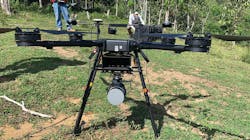
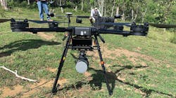
- Acquisition of information in the field. Once the flight plans were available, EPM carried out the planning of this data collection activity. Planning began with the selection of the appropriate technology for the geographic and weather conditions of the flight site. A DJI Wind drone incorporated with the Velodyne Puck Lidar sensor, which uses the precise positioning technique PPK (Post Processed Kinematic) were selected to handle the data collection. These companies were best suited to reach a buffer centered on the main axis of 25 m (82 ft) in width.
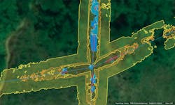
- Information processing. This activity consisted of the treatment of collected data, point cloud classification, data analysis for automatic vegetation detection, geospatial data exchange and consolidation. A vegetation contact-risk map was constructed. Based on different international references, safety distances between vegetation and circuits were selected for the development of the pilot project according to the risk it represented to the integrity of the network, including high risk for distances less than 500 mm (20 inches), medium risk for distances between 500 mm and 4 m (13 ft), low risk for distances greater than 4 m and areas with vegetation above the circuit.
Analyzing Results
With the route defined, it was possible to acquire LiDAR data at about nearly 5 km/day (3.1 miles/day). In similar projects, EPM’s maintenance team for distribution networks has achieved flight yields of up to 12 km/day (7.5 miles/day). Because of regulatory restrictions, the line of sight an operator must have with the flight device, which can reach up to 750 m (2460 ft), was a limitation.
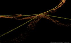
Post-processing, which consists of the classification of the point cloud raised with the LiDAR, took five days. Another three days were needed to process the information with artificial intelligence to create the contact-risk map. In total, processing activities took eight days.
Once the risk map was constructed, results were obtained based on the 6.4-km segment analyzed:
- 12%, or 0.77 km (0.48 miles), had a high level of risk.
- 36%, or 2.3 km (1.43 miles), had a medium level of risk.
- 52%, or 3.33 km (2.07 miles), had a low level of risk.
Therefore, EPM determined about 48% of the network section analyzed had high and medium risks of contact with vegetation that hinder the utility’s ability to meet the expected quality indices.
Recognizing Difficulties
Since the regulation of drone applications in Colombia is relatively recent, obtaining flight authorizations can be somewhat complex. This could lead to delays in future vegetation removal activities when trying to scale this approach across the utility’s territory.
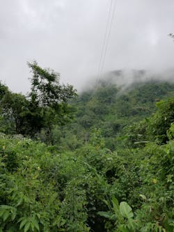
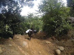
Because of the location of the pilot project, which has high-density vegetation, slopes, limited access roads, unpaved roads and large obstacles, it is not possible for vehicles of any kind to enter. Mules were used to mobilize the equipment, taking between four hours and six hours of travel to takeoff points, significantly affecting logistics. Other adverse conditions exist in the area such as the presence of rain, fog and strong winds greater than 40 kmph (25 mph).
In the first few visits to the site, an absence of electricity supply made it challenging to charge batteries for the drones and other equipment. This may continue to be a constant obstacle in sites with high-density vegetation.
Because of the dynamism of the distribution system in terms of the growing number of new customers, the utility faces a risk of not having real georeferenced routes at the time of drone flights. As such, these aircraft could go by sections that do not exist or were not initially identified. Therefore, reprocessing would need to take place while these sections of the network were georeferenced and then the LiDAR survey would need to be carried out again.
Reaping Expected Benefits
By knowing which sections of the network have medium and high levels of risk for contact to occur between conductors and vegetation, EPM can have greater certainty about where trimming should be completed immediately. Likewise, by identifying the sections of the network with a low level of risk, these sites can be removed from the program. Ultimately, knowing risk levels would result in savings by avoiding unnecessary trimming activity and deploying personnel to critical areas instead.
On certain occasions — because of the long lengths of circuits, geographic conditions and number of circuits in EPM’s system — trimming activities are carried out correctively rather than preventively. This reactive approach results in a decrease in reliability and, therefore, an increase in economic compensations paid out. Improving preventive vegetation management by focusing on the places with more risk of contact would improve the reliability indicators and, therefore, reduce the economic compensation.
To validate the financial hypotheses of the pilot project, the utility conducted a statistical modeling of a cash flow using Monte Carlo simulations to calculate the probabilistic distributions of the financial indicators, associating the input variables (costs and benefits) with the uncertainty level of the development of engineering of the project, represented by a probabilistic distribution.
The costs of implementing this maintenance strategy would be the acquisition of a drone with a LiDAR system, operating costs (drone pilot personnel and drone maintenance) and processing of LiDAR information, among other related costs. The benefits expected to be obtained are a decrease in the payment for compensation and a savings in the trimming-related costs, both in terms of visual tours and in the decrease of the task (since it is selective).
By simulating the cash flow of the project for five years, a probability close to 71% was achieved to obtain a net present value greater than zero (benefits) on the order of several hundred thousand dollars.
Evaluating the Project
With the pilot test, EPM successfully demonstrated the functionality of the technology of information acquisition on its electrical network and vegetation by LiDAR and drone-type aircraft as well as the application of advanced analytics to determine sites with contact risk. Specifically, it was possible to validate its application in hard-to-access sites with rugged topography and high-density vegetation, which are common in EPM’s service territory.
Although the utility faced logistical difficulties in the development of the tasks associated with the collection of field information, the technical capacity to perform this work in adverse conditions was validated. However, to scale this solution, effective planning will be required to minimize the impact of risks identified in the pilot project.
EPM estimated a medium-high probability of realizing economic benefits of several hundred thousand dollars by changing the way it carries out maintenance activities. In this case, it focused on tree trimming in sites identified as having high to medium risk levels for contacts between conductors and vegetation. The foregoing not only increases the reliability of the network, but it also decreases the amount of trimming taking place and reduces the forest use, ultimately lowering the environmental impact of trimming.
About the Author
Diego Mauricio Tauta Rúa
Diego Mauricio Tauta Rúa earned his degree in electrical engineering in 2008 and master’s degree in engineering in 2012. For five years, he worked in consulting services on T&D projects. Then he joined EPM, where he worked on the design phase of T&D projects for five years. In the last two years, he has led the studies and technology management unit of EPM, where he is responsible for the correct assimilation of new technologies in the utility’s operations in all its business lines.
Andres Guillermo Zuluaga Marin
Andres Guillermo Zuluaga Marin earned his degree in electrical engineering in 2010, master’s degree in engineering in 2015 and specialist in project management in 2020. He has worked at EPM since 2016 as a professional of projects and engineering. Previously, he worked for six years in a consulting firm conducting studies on electromagnetic transients and planning for T&D infrastructure. He has experience conducting electrical studies to support designs, specifications and the profitability of operations of the T&D business.
