Unlocking the Benefits of Interoperable Standards
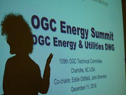
The second Open Geospatial Consortium (OGC) Energy & Utilities Summit brought together world-class researchers to demonstrate the benefits of implementing interoperable geospatial standards within the energy and utility sector. The December 2018 event, titled “Smart Energy Utilities, Communities, and Networks,” aimed to ensure that all electric energy stakeholders have access to technical solutions and data to address specific issues that arise from advances in smart energy technology.
The day-long meeting, held at the Electric Power Research Institute’s (EPRI) lab in Charlotte, North Carolina, US, featured discussions concerning distribution network model data management, visualizing community energy data and technical solutions to common problems using interoperable geospatial standards to inform effective future standards development.
Organized by the geospatial standard organization’s Energy & Utilities Domain Working Group and held alongside one of its quarterly Technical Committee Meetings, the summit focused on the benefits of interoperable utility systems, or systems that exchange and make use of information, in particular location-based information, through standardized protocols and practices.
EPRI outlined its research in the transmission and distribution sectors, including advancements in augmented reality (AR) for engineering applications, training artificial intelligence (AI) models, improving distribution network models in geospatial information systems (GIS), using big data for outage management and preventative maintenance, and supporting the digital transformation of business processes within utilities.
Other participants presented research that improves data exchange for outage management and coordination between utilities to increase network resilience. There were examples of geospatial data and web service standards and models, as well as new approaches to create and integrate network models. The Outage Data Initiative (a standards-based outage reporting system) and Eagle-I (Oak Ridge National Laboratory’s national outage map) were also presented.
The gathering suggested pathways forward to advance OGC web encoding standards and identified areas of future work and research required by OGC to solve current shortcomings in existing standards. Through continued efforts to advance and increase the adoption of OGC’s open, interoperable geospatial standards, the energy and utility sector will continue to benefit from improved situational awareness, providing value across several business processes.
About the Author
Eddie Oldfield
Eddie Oldfield is co-chair of Open Geospatial Consortium’s Energy and Utilities Domain Working Group
John J Simmins
John J Simmins is a technical executive at the Electric Power Research institute (EPRI).

