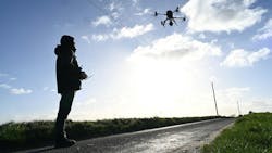
National Grid Plans Series of Drone Flights along Proposed Norwich to Tilbury Route
National Grid will initiate a series of drone flights along the proposed Norwich to Tilbury route to help improve understanding of the landscape and environmental conditions along the corridor, using advanced technology reducing on-the-ground surveys.
The drone surveys by Stirling X, a Norwich-based company with fully certified pilots under enhanced permissions from the Civil Aviation Authority (CAA), will record video footage of the route from heights of around 100 metres (approximately 330 feet). The footage will give project teams a clear, up-to-date view of the landscape and environmental features along the corridor to identify opportunities to reduce impacts on people, wildlife and habitats.
The drones will capture only footage directly relevant to the route and surrounding landscape. They are not equipped to record any personal or property-specific information, and no identifiable individuals will appear in the video. This ensures the survey remains entirely focused on environmental and engineering data required to inform the project’s planning and design.
The drones cover long distances while maintaining high safety standards and minimal disturbance due to the permissions granted by the CAA. Flights will take place in sections of around 5–10 kilometres, with each drone passing over an area only once. The drones will not fly directly over residential properties and will generally operate at a height not making them noticeable from the ground.
Each flight will be managed by a qualified pilot, with trained observers stationed at intervals along the route to monitor the drone’s progress. Operators will work primarily from public rights of way and other accessible areas for take-off and landing, minimizing any impact on local communities and landowners.
The surveys are coordinated with local airfields, including Wattisham, for safe operations. The drones produce only a low level of noise, as compared to an electric lawnmower, during take-off and landing and will be quieter once at operational height.
The video surveys will start near Norwich and work southwards, taking several days to complete the first phase. The footage will be used by National Grid’s environmental and engineering teams to support planning and design work for the Norwich to Tilbury project, part of The Great Grid Upgrade.
The Development Consent Order (DCO) application for Norwich to Tilbury is accepted for examination by the Planning Inspectorate, on behalf of the Secretary of State.
“Our drone surveys are a safe, non-intrusive and efficient way to understand the landscape along the Norwich to Tilbury route,” said James Magson, Senior Project Surveyor at National Grid. “By using this technology, we can reduce the need for teams to walk the entire route on foot, which helps to minimize disruption for local communities, landowners and the environment.”
