Every three years, I was supposed to have a contractor pump out my septic tank. Before he got there, I had to expose the septic tank cover. The cover, though, was about 4 ft below my nice green lawn, and that meant I would have to dig a hole. The every-three-year problem was that I couldn't quite remember exactly where to dig. So typically, only after digging several holes and making a mess of my lawn, I found the cover. Once the contractor pumped the tank, I backfilled the hole and patched the lawn. It was obvious then where the cover was located: the grass patch was round and uneven. Surely, in three years, I told myself, I would be able to find the location in a snap. Well, it's amazing what grass can do in three years. In my case, I noticed it would blend beatifically. Another gorgeous lawn, another day of ruining it with lots of holes.
Why hadn't I simply placed a permanent marker? The reason was clear. The job was done. It was late in the day. It was getting dark. I didn't have a marker with me. I wasn't sure what kind of marker to use. I was tired. Excuses, excuses, excuses.
Problem solved. I sold the house.
Why Location Matters
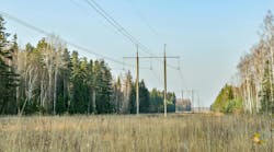
This reminds me of a much more serious problem, which I encountered often while working for the power company. Once upon a time, we were having a rash of cable failures on direct buried 15-kV cables that had been installed in subdivisions years before. When the cables failed, large sections of the subdivisions would lose power. We didn't know exactly where these cables were located. That's because when the contractors first installed the cables, they didn't document the exact locations.
Like me digging holes in my lawn, the poor utility crews had to dig tons of holes just to find the cables. Sure, we could have used metal detecting equipment, but some of the cables were just too deep to uncover. In some instances, the cables were in the street. In others, they were in customers' front yards. The other irony was that after we did find the faulted section of cable and repaired it, we never documented the cable's location while the cables were visible. Why not? The job was done. It was late in the day. The crew was on overtime. They were tired. It was getting dark. Excuses, excuses, excuses.
Fast forward a couple of years. Same crew was back on the same street, doing it all over again. It was costly, disruptive, and unnecessary.
Augmented Reality and GIS to the Rescue
Augmented reality (AR) displays real-time visuals of the world in front of a crew and layers on additional information from other sources — like geographic information systems (GIS) — to provide an "augmented" view of a person's surroundings. Some extra information (like an asset attribute, such as asset age or material type) might be hidden from view. You've probably seen this. In televised football games, the broadcast crews know where the first down marker is, based on information from the officials. To make that clear, the AR application adds a fat yellow first down marker line and yards to go details. The players can't see it. But we can. That's all AR.
With AR and GIS, the field crews would know exactly where to dig. They can point their smartphones on the ground and see exactly where the cables are buried. It sounds great, right?
Not so fast.
The problem has been that most utilities create their GIS from old paper maps. The asset locations, as a result, are often approximate at best or, in a worst-case scenario, only schematically correct. A GIS that inherited this lack of accuracy will bestow it upon any AR given to field crews.
You can't use AR if the GIS assets are in the wrong place.
Three Steps to Get Ready for AR
We know that AR and GIS can save tons of time, reduce costs, and improve customer engagement — not to mention reducing dug up streets and wrecked lawns. How to get started then?
- Create an accurate as-built strategy: Got an exposed asset? This is the time to locate it precisely, in all dimensions (X, Y, and yes, Z). Use external high-accuracy location devices, like the Eos Arrow GNSS receivers, which collect data directly into Esri data-collection apps, including ArcGIS Collector, ArcGIS QuickCapture, and ArcGIS Survey123. Add an accuracy attribute to the asset.
- Prioritize location flaws: AR can't be used in areas where asset location is unreliable. So, identify areas of your network that have known location issues. Then use tools, such as ArcGIS Insights, to identify assets which have the highest consequence of failure. Then work on getting the location correct in those areas first. When you're done, move to the next highest-priority area.
- Find location clues: Even if assets are not exposed, their location can be improved. How? By looking at clues as to their most likely location. For example, a duct bank must start and end at a manhole. Locating these manholes exactly would improve the location of the connecting duct bank (not precisely, but improved). If you've already got GPS equipment from an as-built strategy, consider using an underground asset-mapping solution, such as Eos Locate for ArcGIS Collector, which locates and maps underground assets in real time with centimeter accuracy, straight to ArcGIS Online. Remember to add an accuracy attribute to the asset before you start working.
The three steps above should get your GIS in much better shape to take advantage of AR. To help utilities get started with the concept of AR in the field, Esri has offered the AuGeo app. No custom development is needed to try out AuGeo.
Last Word
AR is a great technology, but only works with accurate information. A big consideration is that the asset locations must be correct in X, Y, and Z. Given the checkered history of GIS data conversion, utilities must create a culture of asset accuracy. If they are going to leverage the substantial benefits of the marriage of AR and GIS, they can start now.
Fortunately, today GIS is more ready than ever to accept the accuracy. ArcGIS allows you to quickly locate assets with high precision using ArcGIS mobile apps. Meanwhile, the Esri Utility Network allows for a full 3D representation of assets.
Another consideration is that for any AR to work, it has to be practical enough for your tired, hole-digging field crews to pick up and use. My septic tank guy wouldn't to want to use bulky, heavy, or otherwise hard-to-use equipment in the field. Finding the most fieldworker-friendly solution is a must, so that AR becomes an easier tool in the field, so that we are not asking our crews to trade their shovel for equally bulky technology.
So, is AR ready to make a difference for your field crews? Try it out yourself. AuGeo gives you a chance to try AR today.
Thanks to Sarah Alban from Eos Positioning Systems and Ismael Chivite, Esri Product Management, for their gracious input to this article.
Thanks to Alec Pestov of vGIS for their work on AR and the use of the image. He can be contacted at [email protected].
To learn more about how GIS improves electric utility operations, click here.