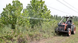
Umanned aerial vehicles (UAVs) soon will change the utility vegetation management industry in North America. Several countries already perform utility corridor inspections using drones, and as soon as regulations are approved for flight beyond line of sight, we will see drones over utility corridors in North America. Vegetation management (VM) companies should prepare themselves for changes arising from UAV inspections.UAVs have the potential to be a disruptive technology in the VM industry. Rapid advancements in optics, computing power, materials and electronics are driving this change. Soon it will be standard for utilities to have at least one visual (video), multispectral (for plant health assessment) and light detection and ranging (LiDAR) scan of their entire corridor network. The question for VM companies will be: How can we adapt successfully to this new technology?To understand these changes, we must understand how future drone inspections will likely be performed. The new process will likely have the following components: aircraft ownership; data collection; database creation and storage; data processing, analysis and monitoring; conflict identification, dispatch and VM; and an updated VM database. We must consider who will control these components to understand how to respond and successfully adapt to this new future. The New Vegetation Management ParadigmFirst, for any large inspection, a drone will fly a length of utility corridor to obtain a set of one or more scans — visual, multispectral and LiDAR — for baseline or follow-up flights on a predetermined timeline. Next, the data must be processed. Scans will be accompanied by telemetry that notes an object’s precise location and dimensions. Each type of scan creates a large amount of data; for example, a LiDAR scan may contain several dozen gigabytes of data per mile of corridor. This fact is important: Most UAV industry analysts expect that data collection and processing will comprise the majority of drone service operations in the future. That is, ‘big data’ will dominate infrastructure inspection services. Then, after the data is processed, analysis must be performed to locate conflicts in the corridor. Soon most of this analysis will likely be automated, and there also will be predictive software to identify future vegetation conflicts based on tree species’ growth curves and repeated drone-based measurements. Finally, after conflicts are identified, they must be communicated to dispatch crews to address these conflicts. The crews must then communicate the completed work to ensure the databases are properly updated, and not necessarily to the company that employs them. This general outline of the likely new VM paradigm has the potential to disrupt unprepared VM businesses and work practices. Sure, the basic work of pruning will not change, but almost everything else will: how corridor inspections are done, who has the information, and how dispatch and work are communicated and coordinated.The Future of Vegetation ManagementLet’s break down a few possible ways businesses will adapt. First, the aircraft. Someone will own them. Will the utility? Some will. Some VM companies will own UAVs, as well, because they will be useful for their other public- or private-sector work. Third-party providers will have aircraft — purchased, maintained and flown with their capital, their staff, their insurance, their depreciation and their risk. Next, the data. Big data is becoming more prevalent as computing power rapidly improves with seemingly no end in sight. Will utilities hire staff and purchase equipment to keep all the data surrounding their corridors? Some will. Will VM companies hire staff, and purchase equipment and specialized analysis software? A few may choose that route to maintain competitiveness. However, the likelihood is third-party providers will crunch and keep all that data; this is the model in the parts of the European Union (EU) and elsewhere that use drone inspection on utility corridors today. It remains to be seen whether the EU model will succeed in North America. Several companies are waiting to be a complete third-party provider in the U.S. as soon as rules are enacted to allow flight beyond line of sight. At the very least, VM companies will have to adapt to technologies using software linking to databases that manage utility corridors; staff will have to be more computer savvy and likely have to enter new types of work data accurately onto a device in the field. Such processes will likely be paired with staff management software to track employee performance, requiring systems and staff capable of running and using big data software. The era of big data is coming, and we have only touched on a few ways it will affect VM. Businesses that are able to adapt successfully will have an advantage in the near future. Is your business ready for this impending new era of big data and vegetation management? Dan Staley is principal of Analemma Resources, LLC, a green infrastructure consultancy in Aurora, Colorado.
Voice your opinion!
Voice your opinion!
To join the conversation, and become an exclusive member of T&D World, create an account today!
Latest from Regulations & Standards
Latest from Regulations & Standards
Sponsored Content
Sponsored Content

