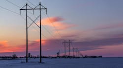
The primary objective of vegetation management is to keep trees and brush from interfering with the conductors and to provide linemen and equipment access to the structures. Utility companies budget thousands and in many cases millions of dollars each year to achieve these goals. However, a few years ago, the linemen at Sho-Me Power (Marshfield, Missouri) weren’t feeling so good about the utility’s outlined vegetation management goals.
The utility and linemen agree that vegetation management work is important. Customers benefit from systematic right-of-way brush control by experiencing lower numbers of outages and shorter outage periods. Field operations benefit from having reasonable access to structures on outage calls and during major storms. But for the Sho-Me linemen who had to shuffle pencils and papers out in the cold and windy winter months, there was a problem.
Before Computers
Each winter, Sho-Me linemen survey the condition of more than 1600 miles of transmission line. They collect data during the winter months, then go back out and make repairs during warmer months. Sho-Me Power has more than 14,000 structures in the field, and in the past, linemen had to complete three separate paper reports for structure condition, rights-of-way condition and gate information.
The linemen would travel in pairs along the company’s transmission lines, filling out forms and making notes about which trees should be trimmed, which poles needed to be repaired and which gates provided the nearest access. Back in the office, photocopies of the forms were distributed to everyone who needed the information, including the people who order new poles and those who work with the vegetation maintenance contractor each spring.
It took a long time for the linemen to fill out all the paperwork in the field, and there was so much paper it was almost impossible to use all the information that had taken so much time to collect. Sho-Me needed a better system for collecting and organizing data, but the utility wasn’t quite sure where to start.
Building a Data File
A first step was creating a computerized database. Each day, linemen began manually entering information into the computer that they had collected from the previous day. This included such information as species and density of the brush plus environmental conditions. Someone would literally enter into the computer the growth conditions, hot spots, repairs that were needed and their location.
While this solution helped make the information more accessible, it was still time consuming and didn’t address the challenges of collecting the data in the field. The utility was headed in the right direction, but what it really needed was an electronic solution that was seamless from the field to the office.
A Portable Solution
The utility began researching options for a computer to use in the field. It became clear that the computer needed to be portable enough that it could be taken out on the rights-of-way and durable enough that it could withstand being dropped from a four-wheeler or being thrown in the back of a truck.
The tool that best fit the needs of the Sho-Me linemen was a handheld unit called the “Recon,” manufactured by Trimble in Sunnyvale, California. Recon meets military specifications for ruggedness and all-weather conditions, plus it operates on Microsoft Windows Mobile 2003, which is compatible with the utility’s computer operating system.
Sho-Me purchased six Recons and worked with Mobile Data Force (Boise, Idaho), a provider of mobile software solutions, to develop an application that included a forms database to make it easy to capture all of the information previously collected by hand on the paper forms. The utility also used DeLorme (Yarmouth, Maine) mapping software to import maps of all of Sho-Me’s transmission structures, lines and power stations onto each handheld unit. And for each unit, the utility purchased a global positioning system (GPS) receiver.
Field Ready
Once the handheld units were loaded with the necessary applications, the linemen were trained and ready to begin collecting data electronically. There wasn’t much of a learning curve because everything was so easy to use. The linemen saw from the beginning that using the mobile computer devices for surveying our transmission lines was going to save us a lot of time. The amount of time the linemen used to spend compiling the paperwork alone made the conversion to electronic data collecting worthwhile.
Each day, Sho-Me’s six line crews set out on their assignments, each team of two equipped with a Recon. Because of the mapping and GPS capabilities, the linemen were able to pinpoint the exact location of each structure, as well as any topographic features such as rivers or ponds that they might encounter along the way.
As the linemen stop at each structure, they move through Recon’s different tabbed screens and record information that falls into one of three categories: the condition of the structure, the vegetation surrounding it and nearby gates.
Point and Click
The whole process of operating the device is basically point and click, which has made the Shoe-Me linemen’s job much easier. The linemen use a pull-down menu on the portable device, checking boxes to indicate specific details under each category, such as the height of the brush in the right-of-way, the drivability of the right-of-way, whether or not there are trees that need to be trimmed, the location and size of nearby gates that provide access to the property, and the condition of each pole.
If the box that indicates a damaged pole is selected, for example, a list of possible explanations such as woodpecker damage or a broken cross arm is generated. Notes can be saved to indicate things such as the location of the nearest gate that is wide enough for utility trucks to fit through. This significantly helps to reduce time when the linemen go out in the spring to make repairs.
Vegetation Management
The new system also has simplified the utility’s vegetation management program. Now, as the linemen move through their assignments each day, they log detailed information about the condition of the right-of-way in the Recon. There are specific fields on the screen; for example, the percentage of right-of-way that needs to be cleared, how high the brush is, the drivability of the right-of-way, whether or not trees need to be trimmed, and other data about the vegetation at a particular location.
At the end of each day, the crews return to the ready-room, where the units are plugged into a desktop computer. The data collected that day are downloaded into the company’s database. The necessary teams can then run reports on the data, such as which trees need to be trimmed and how many poles on a specific section of line need repairing.
In addition to making surveying and reporting jobs easier, the new system also helps streamline the process of working with the contracted vegetation maintenance company. Now, Sho-Me linemen can create electronic reports on what work needs to be done and where. These reports can be e-mailed to the vegetation maintenance workers, saving more time and paperwork.
Determination Pays Off
Sho-Me Power was founded in 1941 on a business philosophy of determination and ingenuity to provide power to its members at the lowest possible price. Those core values were put to work again in making our transmission line rights-of-way surveying program more efficient. The utility is saving time at every step in the process — in the field collecting information and back in the office processing it. But even more exciting for our linemen is knowing they won’t have to stand out in the cold writing everything down with pencil and
paper.
Andy Meyers has served as GIS administrator for Sho-Me Power for 12 years. He has nearly 25 years of experience with GIS and photogrammetry technology and is a member of the Geospatial Information and Technology [email protected]