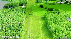
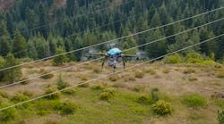
Eagle View Technologies is launching TreeRisk, an intelligent dataset and MapBook derived from EagleView’s proprietary 3D Point Cloud technology. Using high-resolution imagery, TreeRisk is designed to help vegetation managers pinpoint encroachment risks on electric transmission lines and take immediate action to mitigate them.
Vegetation managers are under pressure to find complete, cost-effective ways to identify the locations of vegetation that puts their assets in danger while also keeping their crews safe. TreeRisk highlights potential threats, such as power outages due to trees either falling on or growing into power lines. Users can generate, view and share highly accurate maps while reducing time in the field, eliminating paper waste and minimizing mitigation expenses.
Unlike other applications on the market, TreeRisk uses Pictometry imagery to generate the 3D models, which are more color-rich, realistic and economical than traditional LiDAR models. This solution also comes with a companion MapBook that the vegetation crew can take into the field to easily identify encroaching areas of vegetation.
“With our advanced approach to creating intelligent 3D modeling, TreeRisk is unlike any other technology seen by electric utility companies,” said Rishi Daga, President of EagleView. “We understand the cost and safety risks associated with utility corridors. Combining our high-resolution imagery and accurate datasets will give vegetation managers the precision and confidence they need to succeed in their daily tasks.”


