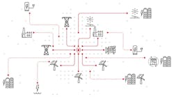
Space‐Time Insight has introduced SI Suite 5.0, a new version of its real-time visual analytics software for utilities and the smart grid. SI Suite 5.0 excels at helping organizations gain actionable insight into massive volumes of data by combining a highly configurable and intuitive end-user interface with advanced analytics based on open standards. The software seamlessly integrates with the geographic information systems (GIS) platform from Esri and correlates and analyzes data from any number of enterprise (IT), operational (OT) and external (XT) sources across space, time and nodes in a network.
SI Suite 5.0 includes new features that make data from disparate systems easily understandable, give business users personalized access to advanced analytics, and run on a range of platforms from tablets to operations center video walls. Highlighted new capabilities include:
- A personalized HTML 5-based user interface that uses rich visualizations, advanced filters and alerts to drive attention to assets and events, providing 360-degree operational insight into data from any number of systems in a single pane-of-glass. Users control specifically what data they want to see and how they want to see it, boosting productivity and speeding decision-making.
- Interactive analytics that uses the open standard R language, bringing analytics out of the “lab” and making it easily accessible to business users. Users are empowered to interactively execute real-time statistical, predictive and what-if analysis of data, reducing the dependence on data scientists to perform analyses on their behalf.
- Delivery through web browsers on desktop, tablets and video walls of data in a wide range of visualization formats including configurable charts and tables, and geospatial presentations enabled by Esri’s ArcGIS location platform. The software easily integrates third-party applications such as SAP, OSIsoft PI and many others, eliminating the need for users to access multiple systems and manually correlate data themselves.