CoServ Electric, a not-for-profit utility serving approximately 110,000 customers in Northern Texas, has gone into production with ArcFM Viewer, which runs on ArcGIS Engine, and plans to rollout with the Redliner extension in April. Seeking to extend the functionality of its GIS solution to include mobile services for workers in the field, CoServ opted to purchase Miner & Miner, a Telvent company’s latest viewing and redlining technology.
Prior to implementing ArcFM Viewer, CoServ Electric printed paper maps detailing everything from switchgear locations to underground cables, for its operations team to use in the field. Now, a total of 27 lineman and servicemen operate ArcFM Viewer to quickly view, query, or analyze current GIS facility data.
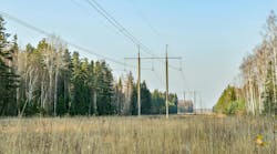
Jack Brown, construction supervisor for CoServ Electric said, “We place a lot of physical equipment in open fields and when we return to the site, the landscape has been altered by construction, making it difficult to relocate our facilities. Now, with GIS in the truck, we are able to access updated digital maps and efficiently relocate our equipment.”
Ronny Allen, lead lineman on underground for CoServ Electric added, “We used to depend solely on dispatch for crucial information. Now that we have mapping and switch status information available on mobile units, we can view the same data as dispatch and collaboratively make decisions. This ability becomes particularly beneficial during storm management when safety must be ensured even while rapidly responding to calls.”
The new application has not only opened up communication between dispatch and crews, but has also facilitated better record keeping for editors. Linemen in the field can now quickly view mapping inaccuracies and contact editors to make the updates. Once the Redliner extension has been installed, crews will be able to further streamline this process by marking their digital maps using a stylus and sending their notes back to editors for integration into the enterprise.
“We’re definitely looking forward to having Redlining functionality. This new technology will take our operation to the next level in GIS efficiency, allowing us to go completely paperless and incorporate new features such as gestures for even greater efficiency,“ said John Long, manager of Information Systems for CoServ Electric.