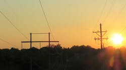
Getting a different view of the grid literally became possible with the invention of airplanes. They provided a new viewpoint, which has proven to be a valuable tool for humanity and the power industry.
Utility aeronautics has become much like a Swiss Army knife with all its multi-tool functionality. Airplanes, helicopters, drones and even satellites are used to perform tasks such as inspections, surveying, construction, maintenance and vegetation management, and the list is growing constantly. With the millions of miles of transmission and distribution lines worldwide, how else can utilities keep up with the demands of a reliable grid?
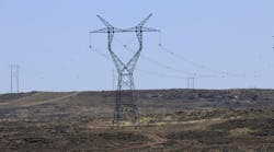
When subtransmission lines are included, the total amount of wire in the air becomes staggering. If that is not enough, individual transmission lines are becoming longer, which is a challenge in itself. These singular lines are built to extreme lengths, linking remote generation with distant load centers such as the 1,480-mile Rio Madeira line in Brazil, the 1,300-mile Jinping-Sunan line in China, the 1,055-mile Inga-Kolwezi line in Congo and the 900-mile Talcher-Kolar line in India.
All transmission requires continued attention throughout the design life, but when lines are as long as those, maintaining one line can be a full-time job in itself. The power industry needs aeronautical technology to meet this challenge. It is surprising how many external factors affect the condition of transmission line components. Probably the most famous problem areas are vegetation encroachment followed by dynamic loadings, but subtler issues such as loose hardware, broken insulators, damaged conductors and structural aging also keep maintenance crews busy.
The difficulty is finding these elusive glitches before they become major problems. Back in the day, linemen performed shake and rattle inspections of the towers on the line, but there are not enough linemen and there is not enough time to conduct inspections that way today. It is no wonder utilities have become so dependent on calling in air support. It has become one of the most important resources in the never-ending process of patrol, identification and repair.
Bird's-Eye View
Airplanes provided a unique vantage point that changed everything. They allowed assessments of transmission line rights-of-way (ROW) much faster than utilities could have ever performed them on the ground. One of the earliest reported aerial inspections of a transmission line took place in 1920. The Tennessee Power Company had a high-tension power transmission line running from Chattanooga to Nashville that was selected for a test of the airborne inspection process. A Curtiss Oriole biplane was sent up with a pilot and two linemen to make the line inspection.
The results were so positive that Tennessee Power’s general superintendent recommended continuing aerial inspections on other transmission lines and that the utility buy an airplane for line patrols. Other utilities also adopted patrolling lines with airplanes, and a new tool flew into the industry’s toolbox — but this was just the tip of the iceberg.
The airplane was great, but it could not get up close. Then the helicopter came along. In 1949, Ontario Hydro (now Hydro One Networks Inc.) became the first utility in North America to purchase a helicopter for transmission line patrols. Other utilities saw the same value the Canadian utility saw, and helicopter line patrols quickly became routine. But it did not stop there.

Aerial Construction
These whirlybirds can fly fast or slow depending on what is needed during a line patrol. They also can stop and hover at any point, but their real potential was not fully realized until turbo-powered helicopters became available in the 1960s. The more powerful engines meant choppers were able to lift much heavier payloads, and the flying crane was born. This adaptation moved helicopter line construction from concept to reality.
Construction companies added these helicopters and shortened construction time while increasing efficiency, which reduced costs. The helicopters also made tough projects workable. Great Basin Transmission South and NV Energy recently completed such a project. Their 500-kV transmission line project, referred to as One Nevada (ON), had to cross challenging terrain (desert and mountains) with demanding climate conditions. Sturgeon Electric implemented its ground crews with helicopter support, and the 231-mile line was built quickly and cost-effectively with minimal environmental impacts.
Some projects defy traditional construction methods, so much so the average engineer may think of them as unfeasible, but today’s technology combined with innovative problem solving can tame the extreme. India’s Ministry of Power has such a transmission project, the Northern Region System Strengthening Scheme. The line will run from Punjab to the Kashmir Valley through dense forests and the snowbound, avalanche-prone Himalayan ranges.
Sterlite Power Grid Ventures and Burns & McDonnell International teamed up on this demanding project along with Erickson Inc. The 280-mile, 2,400-kV Jalandhar-Jammu-Kashmir transmission line will incorporate Erickson’s S64 Aircrane heavy-lift helicopters, micropile foundations and prefabricated towers.
Taking it another step further, SaskPower’s I1k 230-kV transmission line project in northern Saskatchewan, Canada, is a project that relied totally on the helicopter to make it happen. The ROW was remote and not accessible by any form of ground transportation. Whatever came to the ROW, it came by way of helicopter. This project required Valard Construction to use a fleet of helicopters to set about 900 towers and pull in conductor for 185 miles of 230-kV transmission line running from Island Falls to Key Lake.
Construction crews were ferried to the tower locations, towers were placed using choppers, conductor was pulled by them and all other construction activities included some form of helicopter participation. At any given time, there could be a dozen helicopters in the air over the ROW.

Aerial Inspections
Blackouts always attract attention, which definitely happened in 2003 and again in 2007. Vegetation and transmission lines mingled, causing widespread power outages in North America. The 2003 outage brought about new vegetation management regulations, but the 2007 blackout was a game changer. It caused the North American Electric Reliability Corporation (NERC) to look hard at what utilities were doing.
What caught NERC’s attention was finding out the transmission line had not been built as designed. This information caused NERC to investigate several other transmission lines and found the issue was not a one-time occurrence. As a result, the NERC Alert of 2007 was issued, making owners of all transmission lines over 100 kV verify their lines were actually built to the line’s design specifications.
The sheer number of transmission circuit miles and the short inspection time made the solution a no-brainer. The only way to meet the NERC-imposed deadlines was to combine airborne inspections with light detection and ranging (LiDAR) technology. This proved to be a winning combination. The lines were inspected, construction practices validated and problem areas corrected.
Returning to the present time, LiDAR inspections have been adopted across the industry. Utilities routinely fly their ROW with LiDAR mapping, which is costly and generates large data files. The data acquired is time sensitive because vegetation continues to grow and inspections have to be repeated.
Nicholas Ferguson, NM Group’s senior vice president of business development, said, “The update of LiDAR in many utilities for asset management applications was hindered by the cost of application. New systems and workflows enable LiDAR data to be captured at the same time as existing budgeted and scheduled patrol flights.

“The LiDAR system will turn on and off and filter data collection based on the patrol flight regime, for example, when the helicopter stops to hover,” he continued. “As this technique is fundamentally lower in cost than conventional manned LiDAR — where the data is captured from a dedicated flight over the circuit centerline — it is also an order of magnitude lower in cost (10% to 20% of the price). This low cost of application makes the use of LiDAR feasible as part of network-wide annual operations.”
LiDAR is only one of many different imaging technologies available today, with more being added all the time. CenterPoint Energy has been working with Aerotec using oblique imagery (high-resolution, geo-referenced) and video technology. This system uses Google Earth, which is an online geographic information system. Aerotec’s helicopter flies the ROW using high-resolution imaging equipment, but the real wizardry is performed by the software. The result is Google Earth oblique images with 360-degree video. The viewer can pan, zoom, pause, take screen captures and save images of video.
Aerotech CEO Jim Dow said, “The viewer has the ability to watch aerial video segments and ground video segments, allowing them to evaluate the usefulness of this type of video for things like change detection, ROW general conditions, encroachments and other applications.”
Another popular technology is thermal imaging, used by Central Main Power (CMP), which has about 2,500 miles of transmission line to inspect by helicopter. The utility performs yearly infrared inspections, which can detect problem splices and other connectors not seen with visual inspection. Helicopter inspections are an important tool for reducing outages and improving CMP’s operations and maintenance program.
LiDAR, thermal imaging and high-definition photogrammetrics generate big data, which requires computers and software designed to handle it.
“The size of the LiDAR and imagery can be quite large, depending on the length of the transmission line surveyed. This requires tremendous computing power for the service provider, including processors, storage size and RAM,” said Mike Schnell of Pickett and Associates. “To make these larger project files more user-friendly, there are several things that can be done to decrease file size, including converting all imagery to a different format, removing the vegetation points from the model and submitting them separately, or sometimes simply removing the ground points data when feasible.”

Aerial Maintenance
Aerial maintenance is the third part of the aeronautical triad. Helicopters have made it happen. Airborne linemen are fast and efficient, and can perform maintenance on the transmission line when it is energized. These flying linemen replace spacers, dampers, damaged insulators and even portions of damaged structures, whatever the job requires. Performing maintenance on energized conductors from a helicopter is dangerous, but adding water to the equation ramps up things even more.
This is exactly what utilities such as Pacific Gas & Electric, Red Eléctrica de España, AltaLink and Hong Kong’s CLP Power are doing. These utilities and others are using helicopters equipped with a washing rig consisting of a water tank, a high-pressure pump and an insulated boom. The lineman controls a high-pressure stream of demineralized water, washing the insulators clean in a matter of minutes. This is called hot washing the insulators because the line is still energized when the work is performed.
Helicopter vegetation management is an interesting approach to aerial tree trimming. Utilities like Mon Power, a subsidiary of FirstEnergy Corp., are using helicopters equipped with aerial side trimmers. This device looks more like a flying buzz saw equipped with multiple 24-inch rotary-blade saws. The winged saws are suspended from a vertical boom under the helicopter and can trim tree limbs up to 10 inches in diameter. It is not unusual for one of these flying weed whackers to clear 6 miles on both sides of the ROW in a day.
Another uncommon slant is taking place in Sweden where the winters are cold. Swedish wind turbines have experienced a problem with ice formation because of a phenomenon known as glaciated rotor blades. Ice builds up and causes the blades to stop spinning. A helicopter company has developed a solution that uses a different kind of hot-washing technique. It sprays hot water on the blades, melting the ice. According to reports, the process works with temperatures down to -20°F.
Today's Technology
The integration of aeronautics and the grid has been valuable to both parties. It is hard to believe, but the power industry will be celebrating a centennial of aerial line patrols in a few years. Even harder to accept, the industry also is approaching seven decades of using helicopters for utility work. But do not think these aerial platforms are becoming obsolete and ripe for replacement. The evolution of avionics and the adaptations of new accessories have opened new avenues for these venerable flying machines.
Developers are miniaturizing traditional LiDAR equipment, making it more compatible with smaller platforms appearing in the marketplace. At the same time, while these groups have concentrated on miniaturization, others have taken a totally different approach. A new breed of LiDAR technology, photon-counting imager technology has emerged. Massachusetts Institute of Technology (MIT) was one of the first groups to build such a device. MIT used a silicon photon-counting flash LiDAR receiver device called a Geiger-mode avalanche photodiode.
Without going into a lot of scientific detail, Geiger-mode LiDAR imaging systems collect data from large areas at high altitudes using low power flying at fast speeds. The Geiger-mode imager collects data from a large array. The data is take from multiple angles with an extremely high sample rate covering about 3 sq miles versus a traditional LiDAR’s 9 sq ft of coverage. The Geiger-mode LiDAR data delivers 360 degrees of surface illumination. It records the returns of individual photons rather than beam reflections, thus providing higher resolution and reducing shadows and voids while improving foliage penetration. And the data handling allows processing to be reduced from days to hours. The bottom line is the Geiger-mode LiDAR imaging greatly reduces the cost of ROW inspections. As a result, fixed-wing aircraft with Geiger-mode LiDAR have raised the bar.

Fasten the Seatbelt
With accessories such as side-trimming saws, flying cranes and Geiger-mode LiDAR, airplanes and helicopters are critical gear for the transmission grid. Last year, MacroSoft Inc. conducted a global survey focused on the utility’s use of aerial reconnaissance resources. It received 107 responses with approximately 80% coming from the U.S. The responses came from just about every type of utility, including investor-owned utilities (about 50%), municipals and cooperatives.
About 80% said they performed aerial inspections. Helicopters were the most used aircraft followed by airplanes. Transmission lines were the most frequently inspected facilities with distribution lines No. 2 and substations No. 3. This survey shows how integrated aeronautical technology has
become with the electric power industry.
Aircraft have changed the business model for utilities in ways no one could have imagined when the bells and whistles started being added to these flying machines. As long as the industry keeps coming up with unusual ideas — or what some may consider bizarre concepts — someone will turn them into reality, and the rest will wonder how they ever worked without them.