During its annual public service commission operations audit, Owen Electric Cooperative (OEC) is asked a series of questions: When was the last time an inspector was at this location? What type of electric device was inspected? Who was the inspector? Were any deficiencies found? If so, when were the deficiencies corrected?
OEC is a member-owned electric distribution system serving nine counties in the northern Kentucky, U.S., area. With roughly 4,500 miles (7,250 km) of power line to maintain and more than 60,000 members to serve, the cooperative is challenged to maintain a schedule of inspecting all its electric facilities within a two-year cycle.
Over the past few decades, the more challenging tasks for the co-op’s operations department have been to complete line inspections on schedule, organize the inspections and file the data so employees can refer back to it for research as needed. Until recently, the co-op performed all line inspections using a clipboard, a paper map and paper forms to evaluate each feeder. OEC’s journeymen linemen served as the inspectors, but resources became scarce when construction work was busy, and the line inspections schedule would suffer.
Trying to organize all the inspection reports was especially challenging. OEC would spend days organizing its inspections in preparation for a PSC audit. The operations department knew if an accident occurred on the system or possible damage was done to a member’s property as a result of OEC’s electric facilities, the line inspection data could be subject to investigation. When an investigation of this sort would take place, locating documentation and verifying it met the requirements was difficult and stressful.
Therefore, with all the advancements in technology, OEC decided to explore innovative ways to improve its line inspection process.
Search for New Software
OEC began its search in 2013 for software to improve the line inspection process. The co-op assembled a team of employees that represented various departments, including operations, information technology, mapping, engineering, work management and line inspectors. The team spent several weeks outlining the requirements and desires for the software and hardware:
- Meets requirements of the PSC. The PSC requires the utility to inspect all electric facilities at intervals not to exceed two years. The utility must keep appropriate records to identify the inspection conducted, the date and time of inspection, the person conducting the inspection, deficiencies found and action taken to correct the deficiencies.
- Uses electronic field devices. OEC wanted inspectors to go paperless when performing inspections. The device needed to be user friendly, rugged and weather resistant.
- Requires minimal training. The co-op did not want to send employees to a training course to use the software. The software needed to be user friendly so someone with minimal computer proficiency could learn it quickly.
- Does not decrease efficiency. Data entry in the electronic device needed to be simple and fast. The utility wanted to adopt software that would reduce the time taken in the field to collect data in the form of inspections and work orders. It did not want software that would increase the time as a result of having to navigate through various options and layers.
- Uses OEC maps with GPS. OEC maps must be loaded onto the device with GPS tracking to guide the inspector through the feeder. OEC required that each inspection be identified on the map to ensure all electric facilities were inspected.
- Captures time stamps. The software must identify the inspector, inspection time and electric facility inspected. This information needed to be attached to each inspection automatically to satisfy the regulations of the PSC.
- Associates pictures with inspections. An inspector may come across a deficiency that needs to be addressed by one of its member owners. By having the ability to capture a picture while on site and link it to the inspection, office personnel would be able to see the deficiency and better explain it when speaking to the member.
- Tracks inspections. For budgeting and planning reasons, OEC wanted to track the number of inspections performed during specific intervals. To forecast workload and personnel hours, the co-op sought a tracking mechanism to indicate the number of inspections performed year to date.
- Provides reports for compliance with PSC. A report needed to be available, by feeder, listing all inspections and deficiencies.
Over the next 18 months, OEC’s team researched several vendors, but no one quite met all the requirements. OEC was to the point of giving up on its search when team members attended a webinar presented by GISbiz on iPad use for field inspection applications. After the webinar, OEC contacted GISbiz, and within a week, GISbiz was at OEC’s office to discuss its needs and ideas for line inspection software. After numerous discussions, GISbiz implemented geoOrganizer, which contains a suite of products OEC can use to track its inspections. This was an ideal partnership for both OEC and GISbiz.
Field Inspections
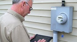
OEC hit the ground running with the deployment of the suite’s field inspection tool, geoFIT, in June 2014. Utility personnel had high praise for the ease and efficiency of use of the electronic field device as well as the minimal training needed by line inspectors. Generating a report of all inspections and deficiencies occurred within minutes of the actual field inspection. If necessary, OEC could generate a report daily on all the work performed. All reports and tracking are easily accessible with user-specific log ins to a web-based geographic information system (GIS) dashboard application called geoDASH.
A notable cost- and time-saving measure that came about after implementing geoOrganizer is that OEC now has one full-time line inspector. Whereas OEC used to have its linemen perform line inspections as resources allowed, now the co-op is able to channel workflow more consistently to one inspector. Additionally, the line inspector is able to report from home as needed. With the time-stamp feature in geoFIT, OEC can verify the start and finish time and, with GPS, the location of the inspector when performing the inspections.
By having the ability to track inspections, OEC is able to evaluate the expenses incurred during line inspection and budget for the expenses more accurately for the year. OEC is tracking physical inventory, costs per unit of inventory and time spent per unit.
With its line inspection on a two-year cycle, the cooperative plans to use the data collected in 2014 to budget for 2016. During 2014, OEC’s line inspector spent approximately 1,000 hours inspecting 2,500 miles (4,023 km) of line. Assuming no significant changes in growth for 2016, the co-op can use this data to forecast its expenses for 2016.
Aerial Inspections
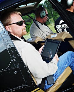
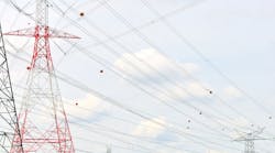
After seeing how geoFIT improved the workflow for line inspections, OEC decided to take the software in the air. The cooperative provides electric service to the Kentucky Speedway, which hosts a NASCAR event annually in July. In preparation for the race, OEC inspectors fly over the feeders serving the speedway to check for any major deficiency that could lead to a power outage during the race.
In the past, the utility personnel would use a paper map to mark an area where they sighted a deficiency. When returning to the office, the personnel would create a work order for the general, as opposed to a specific, area they marked with the deficiency. By taking geoFIT in the air, OEC was able to mark the specific pole it knew needed attention and sync the information in real time to the office. The reports became more accurate and detailed, improving the utility’s work orders.
OEC has since implemented the use of geoOrganizer into its storm-assessment procedures. In the event a storm takes out a large portion of the service territory, the co-op will take geoFIT in the field to send real-time updates to the office about any damages. This can be done from the ground or air.
In October 2014, OEC tested geoOrganizer during a mock outage. The utility sent employees into the field and the air to compare the speed in gathering data. The ground inspectors assessed areas previously marked with down power lines, right-of-way issues or broken poles. The aerial inspectors looked for right-of-way issues since OEC is currently working to manage the effects of the emerald ash borer on its entire service territory. By looking for the right-of-way issues from the air, the utility was able to get a better idea of what it was facing.
When OEC used paper maps to mark a general area where an issue was identified, by the time the inspector returned back to the office to relay the problems, some would be forgotten. By using geoOrganizer, the information gathered has become more accurate and the speed in gathering the data has improved. In fact, the electronic field device is able to operate properly at speeds of 40 mph (65 kmph) and at altitudes of more than 200 ft (61 m).
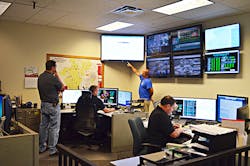
Now when identifying a problem, the inspector inputs the information into geoFIT and sends it immediately to the office. The inspection data is viewed on a monitor in the storm center as the assessment is being performed which allows office personnel to plan for restoration. This process can reduce the outage restoration time considerably.
Great Improvements
Taking the line inspection process paperless has greatly improved the cooperative’s daily work processes:
- The cooperative now has one full-time line inspector reporting deficiencies as opposed to several part-time inspectors.
- Field personnel are more efficient.
- The data reported is consistent and deficiency reports are more accurate.
- The geoFIT implementation allows the inspector to select a specific field asset for inspection.
- The inspection data transmitted to the office is exactly what was reported from the field.
The utility found the solution it was looking for in GISbiz. Not only did the software meet its needs, but it also satisfies the PSC requirements. The utility can now confidently verify all its field assets have been inspected.
Rusty Williams ([email protected]) is the senior vice president of operations and technology at Owen Electric Cooperative. He graduated from Kentucky State University with an associate’s degree in electronics technology and has 28 years of experience with Owen Electric Cooperative. While there, he has held various positions within the operations and maintenance department.
Gabrielle Welsh ([email protected]) is the administrative assistant for the operations and technology department at Owen Electric Cooperative. She was involved with the implementation of geoOrganizer and manages the daily business process of line inspection. She has an accounting degree from Morehead State University and four years of experience with the cooperative.


